Fansipan Before the Cable Car
Cat Cat Route - 3 Days 2 Nights - 2015
These days, people reach the top of Fansipan in 15 minutes by cable car.
In 2015, when I made the trip, the only way to touch the highest peak in Vietnam was on foot. Back then, climbing Fansipan was still a matter of forest and mountain, porters, sleeping huts, and muddy trails.
At that point I had already visited the four extreme points of Vietnam. Only one summit remained to complete what Vietnamese backpackers call the "4 extremes, 1 peak" challenge. Fansipan was that last peak.
There are several routes to the top. The three most well-known are: Tram Ton (easiest, 2 days 1 night), Sin Chai (moderate, 2-3 days), and Cat Cat (hardest, 3 days 2 nights).
I chose Cat Cat.
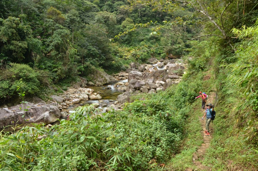
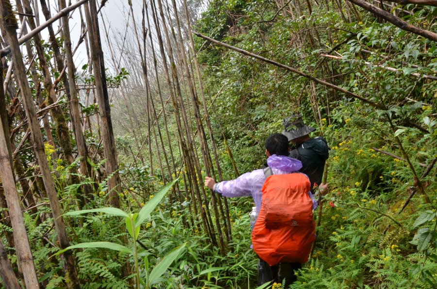
Day 1 - The Hoang Lien Son Forest
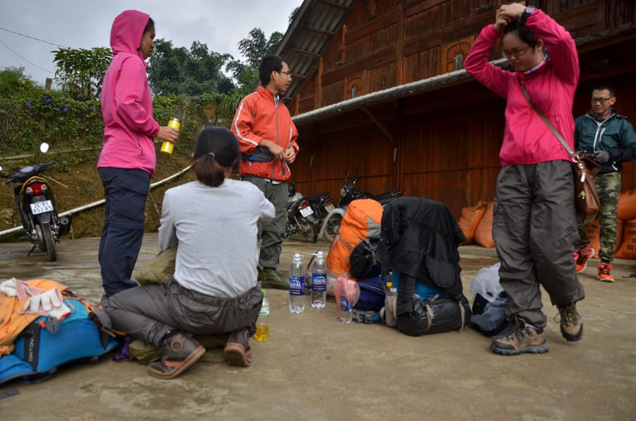
8 AM. We gathered at Ban Cat Cat village. The sky was overcast.
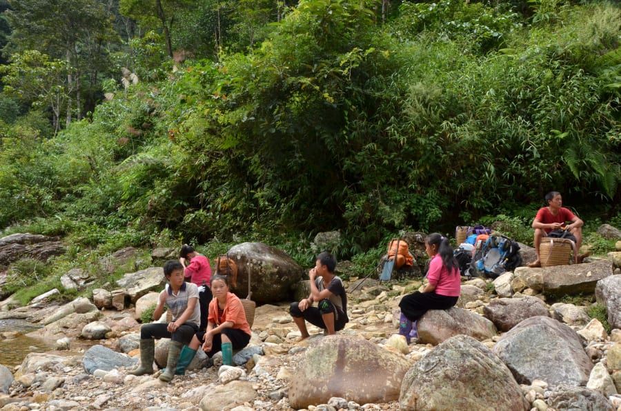
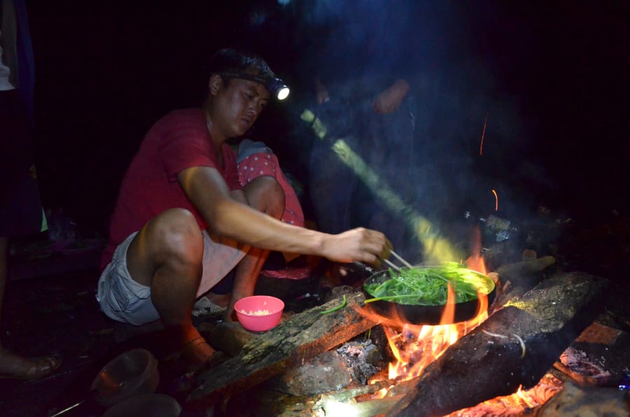
Our group totaled 10 people - 6 trekkers and 4 porters. We needed that many porters because they handled everything: navigation, food, and all the equipment needed for three days on the mountain. No porters, no trip.
The first steps wound through the Hoang Lien Son forest. High humidity, cool air heavy with the smell of wet earth. The sound of streams carried further than our footsteps.
We stopped at a stream around 11 AM - sitting down, I realized my legs had already started to ache. By mid-afternoon, some people were getting cramps.
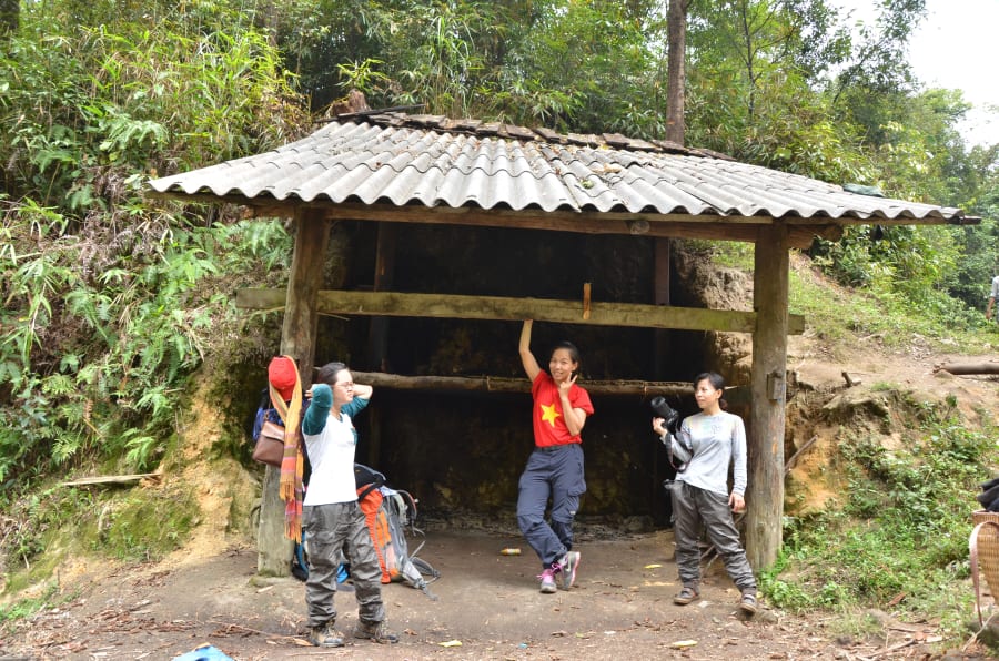
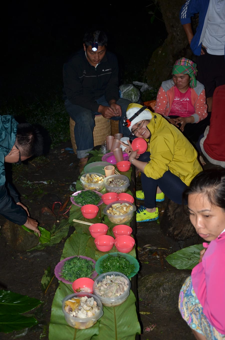
5 PM. We reached the first shelter.
The campsite was a flat, open clearing. Someone had already built a simple hut there - bamboo frame covered with a tarpaulin, enough for 7 or 8 people to sleep. I looked at it and thought: that seems warm enough for tonight.
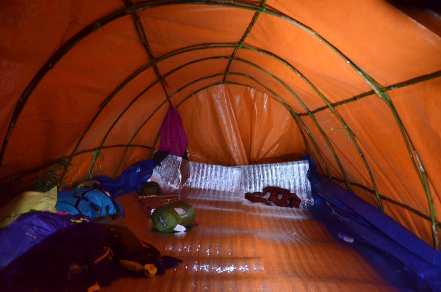
Everyone dropped their packs. The porters started on dinner. After a full day of hiking, the meal tasted surprisingly good.
But dinner wasn't the highlight of that evening.
While we were eating, from the grass behind the huts - a flash of green light blinked in the dark.
Then another.
Then a few more.
And within less than a minute, the entire forest behind the camp began to glow.
Fireflies.
Hundreds of them drifting through the Hoang Lien Son forest, blinking on and off as if someone had scattered a sky full of stars across the ground. We abandoned our food and ran toward the dark grass, standing there in silence.
It was the first time in my life I had seen so many fireflies at once - and to this day, it remains the only time.
More than ten years have passed and I still remember exactly how that night felt. A forest switching on its lights to welcome a group of strangers.
No camera could have captured it. And probably no screen could ever convey it either: the cold of the mountain at night, the smell of wet earth, the sound of a distant stream, and an entire forest glowing in the dark.
Day 2 - The Phone at 2,900m
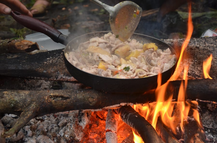
Up early the next morning. The porter's fried rice was excellent. We ate and got moving.
The trail was steeper. The humidity higher. I started to feel the weight in my own legs - and in my stomach too.
At 2,900m, we stopped for lunch. I took the opportunity to answer nature's call. Relieved, I walked on.
Thirty minutes later, I realized I had left my phone at the lunch stop.
I didn't want to hold the group up. Didn't want anyone to turn back because of me. So I told myself: "It's probably just sitting at the bottom of my bag somewhere."
That afternoon, we set up camp at 2,800m.
(The Fansipan trail doesn't go straight up - there are sections where you climb, descend, and climb again. Don't be confused by the fact that we were at 2,900m at lunch and 2,800m by evening.)
And sure enough, it was somewhere.
Just somewhere at 2,900m.
People said the sky that night was full of stars, very beautiful. Whether there were stars or not - I don't remember. Whether the food was good - I also don't remember. All I remember is that every photo from the trip, the entire GPS tracklog of the journey, was sitting up there at 2,900m. It honestly felt like heartbreak. At least I still had my camera - that's the only reason I have any photos from this trip at all.
I went to sleep at 8 PM, ignoring everyone still eating and laughing outside.
But sleep didn't come.
The cold at 2,800m, combined with the forest humidity, worked its way into every muscle. I rubbed through nearly an entire bottle of medicated oil and still couldn't get warm. I lay in my sleeping bag staring at the ceiling of the hut, thinking about the photos.
Temperatures at 2,800m+ drop significantly at night even in October. Bring a proper sleeping bag rated for at least 5°C, a full change of dry clothes sealed in a plastic bag, and more medicated oil than you think you need.
Day 3 - The Summit, the Rain, and the Way Down
Morning. My body and mind were both exhausted. Some of the men in the group were already showing signs of cramping. Only 200 vertical meters to go.
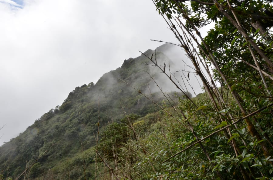
Light rain had started - or maybe it was mist, I couldn't tell. Everyone put on rain jackets. The large trees gradually disappeared. On both sides of the trail now: just bamboo and mud.
Then I heard shouting from somewhere up ahead.
From the tone of the yell, I knew immediately - someone had spotted the summit. I forgot about the exhaustion and the cold and pushed my pace.
And then I saw it.
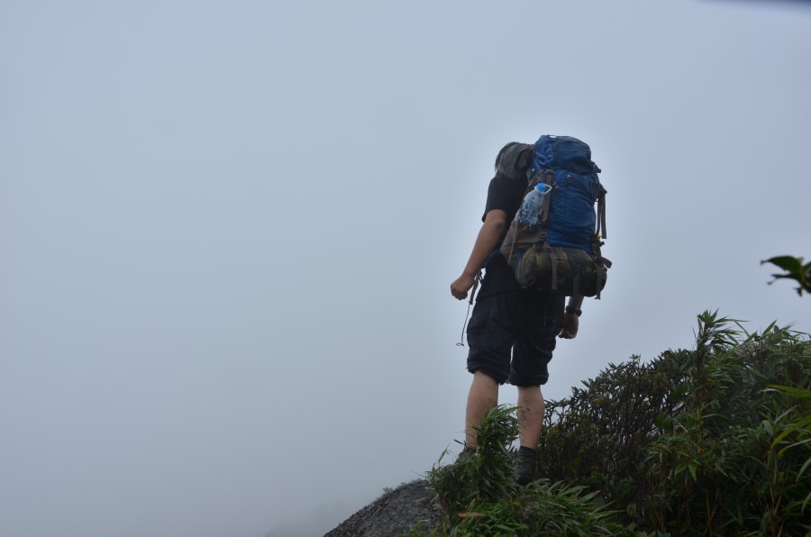
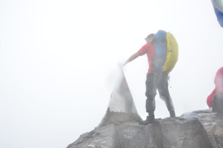
In 2015, the top of Fansipan was nothing more than a simple stainless steel marker. No structures, no buildings around it. The clouds and rain meant I couldn't see anything in any direction - just the marker and white mist on all sides.
I had spent nearly three days climbing, lost my phone, and nearly frozen to death, just to stand here for a few minutes in the rain. But that was fine. What mattered was that I could see it - that stainless steel marker.
I took a few quick photos, hugged the marker for a moment, and headed straight back down.
On the descent, I noticed what looked like a large construction site near the summit. At the time I had no idea what it was.
I didn't think much about it then. I only thought: I made it up here, I got to see this peak, I got to hold it - before anyone turned it into something commercial.
(Years later, I understood what that construction site was. The cable car station.)
Back down via the Tram Ton trail. Stopped at a shelter to dry our clothes and socks. 2 PM, we continued.
I walked ahead of the group - figured I knew the way by now, could manage on my own. Passed several people heading up in the opposite direction, felt confident.
Then suddenly, no one was coming up anymore.
Oh no. Am I lost?
I stopped. Stories started surfacing in my memory - people who had gotten lost in mountains like this and never made it back. Some of them, even here on Fansipan, were never found at all. That thought scared me even more. When I get scared, I always seem to need a bathroom break. So I ducked behind a bush, in the pouring rain, and waited.
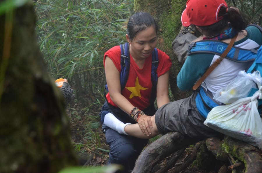
Then a figure appeared - not a porter, but his wife. She was the same age as me, but looked far more composed than I was. I felt like I had just been rescued.
I asked her what was happening. Turned out she was also doing this route for the first time - following her husband. I was embarrassed.
I was still on the right path. Just 500 more meters to the rest shelter.
I only understood later why no one had been coming up: after 3 PM, no one attempts the ascent anymore because they won't make it to the shelter before dark. I had panicked unnecessarily. But the decision to stop and wait - that was the right call.
If you're not sure about the path, don't keep going. Just stop.
That's not a motivational quote. It's something I learned standing alone on a mountain trail in the rain. The mistake was walking ahead of the group in the first place. Young and reckless.
After 3 PM, you will not encounter anyone heading up the trail. This is normal - not a sign that you're lost. If unsure, stop and wait for your group or porter. Do not continue alone.
We waited at the shelter for everyone to regroup, then headed down again around 3 PM. The rain came down harder. Streams began to swell and rush. Daylight was fading.
The porters discussed something among themselves in their native language - I couldn't follow a word. Later I found out they were deciding which route to take, because one section of stream had risen too high to safely cross.
And it really was swollen. At one point I genuinely couldn't figure out the crossing - go straight across or follow the current downstream? It was nearly dark, and my eyes and legs had nothing left. I just followed the porter. Every step felt unsteady. One of the porters had to carry a woman in the group across on his back.
7 PM. I saw lights in the distance.
We made it back to the starting point. Someone handed us certificates: "Successfully Conquered Fansipan."
I'm not sure whether they still give those out. But holding it then, I found it a little ridiculous. No piece of paper could tell me what I had or hadn't done. And I didn't need one to tell me. What I needed was the feeling that the mountain had welcomed me, had let me pass through, had treated me well.
That was enough.
Looking back now, I think the phone I left behind at 2,900m wasn't entirely a loss. Without it, I had nothing to look at, nothing to photograph, nothing to distract me. I had no choice but to use everything else - eyes on the bamboo forest on either side of the trail, ears on the sound of the streams, skin feeling the cold cut through to the bone.
The mountain showed me how it wanted to be experienced.
Today, people reach the summit of Fansipan in a 15-minute cable car ride.
The Fansipan I remember is still rain, mud, fireflies, and dark trails through the Hoang Lien Son forest.
Thank you, mountain, for treating me well.
How to Trek Fansipan
This account is from 2015. The cable car has been operational since 2016 - the trekking routes still exist but the experience and logistics have changed. The notes below reflect current conditions as best as I know them.
The three main routes
- Tram Ton (easiest): 2 days 1 night, ~14km. Most popular, highest starting elevation (~1,900m)
- Sin Chai (moderate): 2-3 days, longer approach through more remote forest
- Cat Cat (hardest): 3 days 2 nights, lowest starting elevation, most elevation gain, least traffic
Porters
- Mandatory for all routes - you cannot trek without a registered local guide
- Book through licensed operators in Sapa town
- Porters carry food, equipment, and cooking supplies for the group
What to bring
- Sleeping bag rated for 5°C or lower
- Full dry change of clothes in a sealed plastic bag
- Rain jacket and waterproof pants
- Trekking poles - the descents on day 3 are hard on the knees
- Headlamp with spare batteries
- More medicated oil than you think you need
When to go
- September to November: clearest skies, best summit visibility
- Avoid January-February (coldest, possible ice on trail) and June-August (peak rain season)
October is the sweet spot - post-monsoon, the forest is vivid green, humidity has dropped, and you have a reasonable chance of a clear view from the summit.
Do not attempt any Fansipan route without a registered guide. The trails are not well-marked, mobile signal disappears within the first hour, and accidents on this mountain have been fatal.