The Ha Giang Loop is one of the most rewarding rides in Southeast Asia. It's also one of the most unforgiving if you show up underprepared.
This guide covers everything you actually need to know - licensing rules that catch most Western travelers off guard, road conditions, weather, costs, and a few things learned the hard way.
Table of Contents
- Logistics
- Bikes & Licensing
- Police & IDP
- Road Conditions
- Timing & Weather
- What to Pack
- Food
- Money & Connectivity
- Accommodation
- Safety & Reality
Logistics
How many days do I need for the Ha Giang Loop?
Most travelers complete the loop in 3 nights / 4 days, which gives enough time to ride at a comfortable pace without rushing through the highlights. If you want more flexibility to explore side roads, stop at viewpoints, or rest on tough riding days, 4 nights / 5 days is the better option.
The 3N4D itinerary typically looks like this: Ha Giang → Quan Ba → Yen Minh → Dong Van → Meo Vac → Ha Giang. This is the minimum recommended - doing it in 2 nights means long daily distances on mountain roads, which is exhausting and increases accident risk.
3N4D is doable but you'll feel it by day three. If your schedule allows, the extra day makes a real difference - less rushing on the passes, more time at viewpoints, and you actually recover between riding days.
Should I ride clockwise or counter-clockwise?
The most common route is counter-clockwise: Ha Giang → Quan Ba → Yen Minh → Dong Van → Meo Vac, then back via Ma Pi Leng Pass. This direction is widely recommended because you approach Ma Pi Leng from the Dong Van side, which gives the better view of the Nho Que River canyon below.
Riding clockwise means tackling Ma Pi Leng early, which some riders prefer to get the hardest section done while energy is high. There's no wrong answer, but counter-clockwise is the default for a reason.
Should I travel from Hanoi or go straight to Ha Giang?
Ha Giang city is approximately 320km from Hanoi - about 5-6 hours by bus or 7-8 hours by motorbike. Most travelers take a sleeper bus directly from Hanoi's My Dinh bus station, arriving in Ha Giang in the morning ready to start.
Riding from Hanoi by motorbike adds significant distance and fatigue before the loop even begins. Unless you're doing a longer northern Vietnam trip, the bus is the smarter option.
Buses run daily, tickets cost around 200,000-250,000 VND, and several companies offer direct routes. Book in advance during peak season (October-November).
How much does the Ha Giang Loop cost in total?
Budget travelers can complete the loop for around $50-80 USD (approximately 1.2-2 million VND) for 4 days, excluding the bus from Hanoi. Mid-range travelers should budget $100-150 USD.
| Item | Cost |
|---|---|
| Motorbike rental | 150,000-250,000 VND/day |
| Easy Rider guide | 500,000-800,000 VND/day |
| Accommodation | 100,000-250,000 VND/night |
| Food | 50,000-100,000 VND/meal |
| Fuel | ~150,000-200,000 VND total |
| Border permit | 200,000-250,000 VND |
Cash is king on the loop - carry enough before leaving Ha Giang city.
Do I need to book anything in advance?
During peak season (October-November for buckwheat flowers, January-February for rapeseed flowers), accommodation fills up fast - especially in Dong Van and Meo Vac. Book at least 2-3 days ahead during these periods.
Off-peak, walk-in is generally fine except on weekends. Easy Rider guides should be booked at least a few days in advance year-round - quality guides fill their calendars quickly.
Bikes & Licensing
Should I self-ride or hire an Easy Rider?
This depends entirely on your experience level and what kind of trip you want.
Self-riding gives you full freedom - stop whenever you want, set your own pace, take detours. It's also cheaper. However, the Ha Giang Loop is not a beginner's route. Roads include steep mountain passes, loose gravel sections, and blind corners.
Hiring an Easy Rider costs more but comes with genuine advantages: local knowledge, navigation, emergency support, and often great storytelling about ethnic minority communities along the route. For solo travelers with limited riding experience, this is the safer and often richer experience.
A middle option gaining popularity: self-ride with a guide leading on a separate bike. You get the independence of riding yourself with a safety net ahead.
If you've never ridden a manual bike on mountain roads before, hiring an Easy Rider is the smarter call.
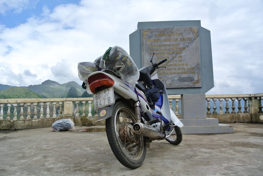
Where should I rent a bike and what type?
Bikes can be rented in Ha Giang city from numerous shops near the town center. Daily rates range from 150,000-250,000 VND.
- Honda Win / Minsk: cheap, iconic, but mechanically unreliable - breakdowns are common
- Honda XR150 / CRF150: the preferred choice for most experienced riders - more reliable, handles rough terrain better
- Semi-automatic (xe số): required for the loop's terrain; avoid automatic scooters on mountain passes
Always inspect the bike thoroughly before renting: check brakes, tires, lights, and engine. Take photos of any existing damage. Reputable shops will provide basic tools and a pump.
Police & IDP
Which driving license is valid in Ha Giang?
This is one of the most misunderstood topics for foreign riders in Vietnam - and Ha Giang is one of the strictest enforcement zones in the country.
Vietnam recognizes International Driving Permits (IDP) issued under the 1968 Vienna Convention only, combined with your original home country license. Your IDP must also specifically include motorcycle categories (A1 or A2).
US, Australian, and Canadian travelers: Your country issues IDPs under the 1949 Geneva Convention, which is NOT valid in Vietnam. Vietnamese police will treat a 1949 IDP as no license at all. This affects a large portion of Western travelers and is one of the most costly mistakes made on the Ha Giang Loop.
Countries with valid IDPs include most of Europe, Japan, South Korea, and other 1968 Vienna Convention signatories. Check your country's convention status before assuming your IDP works.
ASEAN nationals (Thai, Lao, Cambodian, etc.) can use their national license directly without an IDP.
Are there checkpoints on the Ha Giang Loop?
Yes. Enforcement has become significantly stricter since late 2025. Checkpoints are most commonly found at the entrance to the loop area and at key points along the route.
Officers typically check:
- Passport
- Valid IDP (1968 Vienna Convention version)
- Original home country driving license
- Helmet compliance
Do not rely on the assumption that police will let you through - enforcement in Ha Giang is more rigorous than most other tourist routes in Vietnam.
What happens if I get fined?
If stopped without a valid license, expect a fine of approximately 2-5 million VND (roughly $80-200 USD) as of 2025-2026 regulations. Police also have authority to impound your bike for 7 days.
If your bike is impounded and you're renting, this becomes a serious problem - you'll need to contact your rental shop immediately and may be liable for rental fees during the impound period.
Getting the right IDP before leaving your home country eliminates this risk entirely. IDPs cannot be obtained in Vietnam.
Road Conditions
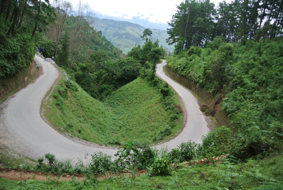
How difficult are the roads on the Ha Giang Loop?
The Ha Giang Loop involves some of the most challenging riding terrain in Southeast Asia. Roads are narrow, winding, and often unguarded - meaning a single mistake on certain passes can have serious consequences.
Most of the route is paved, but sections near Du Gia and some secondary roads involve gravel or dirt. After rain, even paved roads become slippery, and landslides can temporarily block routes.
Daily riding distances of 100-150km may sound manageable, but on mountain roads this translates to 4-6 hours of concentrated riding. Factor in fatigue carefully, especially on multi-day trips.
Which passes are the most dangerous?
Ma Pi Leng Pass is the most famous and the most serious. It stretches approximately 20km along cliff edges above the Nho Que River canyon, with drops of several hundred meters on one side and minimal barriers. The views are spectacular; the stakes are real.
Pai Lung Pass (Đèo Pải Lủng) and Quan Ba Pass (Đèo Quan Ba / Cổng Trời) are also significant challenges, with steep gradients and tight corners.
None of these passes are impossible for competent riders, but all demand full attention, appropriate speed, and good brakes. Check your bike's brakes thoroughly before attempting any of these.
How do rain, fog, and landslides affect the ride?
Rain is the biggest variable on the loop. Roads become slippery within minutes of rainfall, and visibility drops sharply in fog - common in early mornings at altitude. March-April brings hail at higher elevations.
Landslides occasionally block roads, particularly after heavy rain in the wet season (May-September). Local riders and guesthouses usually have current road condition information - always ask before heading out.
If weather turns bad mid-ride, the correct decision is always to stop and wait. Pushing through fog or rain on mountain passes is how accidents happen.
Timing & Weather
What is the best time to visit Ha Giang?
Ha Giang has two iconic flower seasons that draw the most visitors:
- October-November: Tam giac mach (buckwheat flowers) bloom across the Dong Van Karst Plateau - deep pink fields against limestone mountains. This is peak season and the most photographed period.
- January-February: Cai vang (rapeseed / yellow mustard flowers) cover the valleys. Fewer crowds than buckwheat season, colder temperatures.
Outside of flower seasons, March-May offers good weather and manageable crowds. June-September is rainy season - roads are harder but landscapes are dramatically green and lush.
What is the weather like on the Ha Giang Loop?
Ha Giang sits at elevations ranging from 300m to over 1,600m, which means temperatures vary significantly across the route and throughout the day.
| Month | Temperature | Conditions |
|---|---|---|
| Jan-Feb | 5-15°C | Cold, occasional frost at night, dry |
| Mar-Apr | 15-22°C | Warming up, possible hail, foggy mornings |
| May-Jun | 20-28°C | Getting wet, green landscapes |
| Jul-Sep | 22-28°C | Peak rainy season, landslide risk |
| Oct-Nov | 15-25°C | Best weather, buckwheat flowers |
| Dec | 8-15°C | Cold and dry |
Morning temperatures are always significantly cooler than midday - riding at dawn in winter months can feel very cold even when afternoons are comfortable.
Can I do the loop during rainy season?
Yes, but with adjusted expectations. Rainy season (roughly May-September) brings daily afternoon showers, reduced visibility, slippery roads, and occasional route closures from landslides. The upside: landscapes are intensely green, waterfalls are full, and crowds are minimal.
If riding during rainy season, plan to start each day early to beat afternoon rain, carry a good rain poncho, and build flexibility into your itinerary for weather delays.
What to Pack
What should I wear on the Ha Giang Loop?
Many first-time visitors underestimate how cold Ha Giang gets, especially at altitude and in the early morning. Shorts and t-shirts are insufficient for most of the year outside of peak summer.
- Base layer (thermal or lightweight long-sleeve) for mornings
- Mid layer (fleece or light jacket) for evenings and higher elevations
- Windproof outer layer - essential for riding at speed in cool temperatures
- Long riding pants - protects against both cold and road rash
- Gloves - hands get cold fast on mountain passes
- Closed-toe shoes - sandals are dangerous on a motorbike
Even in October-November (peak season), morning temperatures at Dong Van can drop to 10-15°C. Pack layers regardless of when you visit.
What should I bring on the Ha Giang Loop?
- Cash - sufficient for the entire loop
- Rain poncho - buy a quality one, not a 20,000 VND disposable
- Sunscreen - UV is stronger at altitude
- Headlamp / flashlight - power cuts happen at guesthouses
- Basic first aid kit - cuts and scrapes from falls are common
- Motion sickness medication - winding mountain roads affect many people
- Offline maps - download Maps.me or Google Maps offline before leaving Ha Giang city; signal is unreliable
- Portable charger - keep phone charged for navigation and emergencies
- Copies of important documents - passport, license, IDP
Food
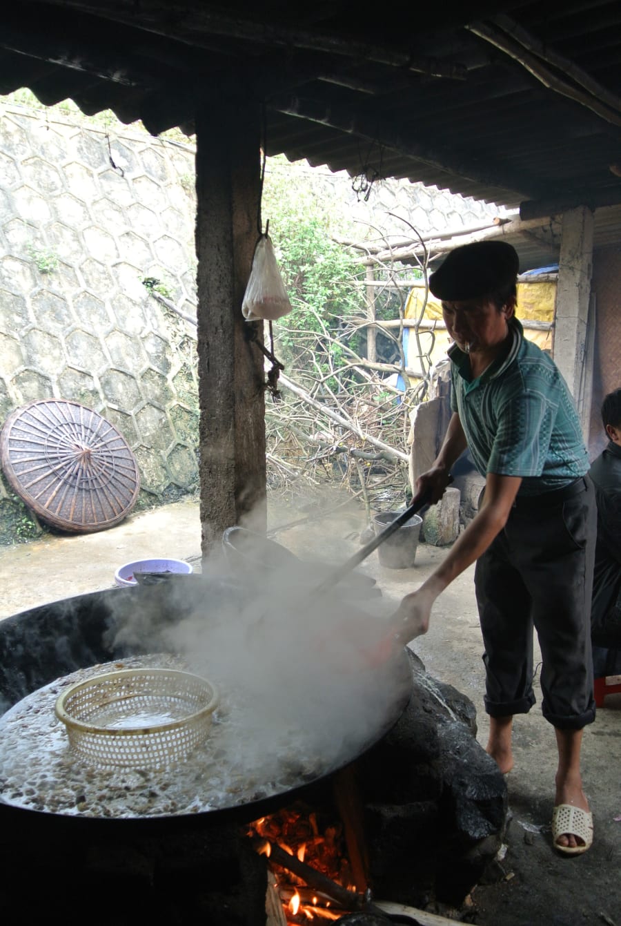
What can I eat on the Ha Giang Loop?
Food options along the loop are simple but authentic. Most guesthouses and homestays serve meals - inform them in advance if you want dinner, as many prepare food to order.
- Thắng cố - a traditional H'Mong stew made from horse or buffalo meat and organs, slow-cooked in a large pot
- Mèn mén - steamed corn flour, a staple food of ethnic minority communities in Ha Giang
- Cháo ấu tẩu - a medicinal porridge made from aconite root, believed to warm the body. Popular in Dong Van, best eaten in small amounts
- Thịt lợn cắp nách - small free-range pigs roasted over wood fire, common at local markets
- Corn wine (rượu ngô) - the local spirit, distilled from corn. Offered frequently at homestays
Vegetarian options are limited outside of Ha Giang city. If you have dietary restrictions, communicate clearly and carry backup snacks.
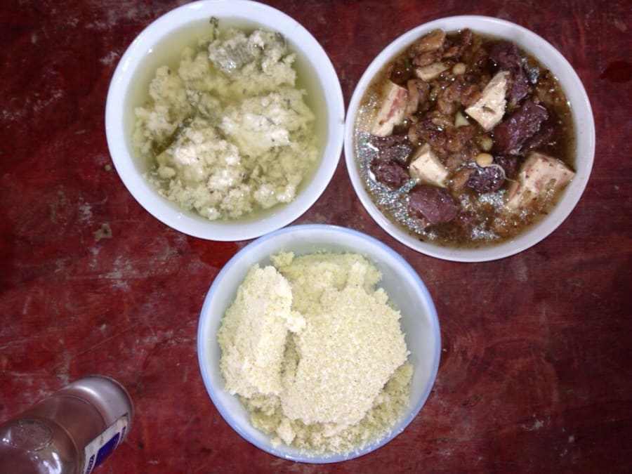
I remember being genuinely excited to try thắng cố for the first time. Then I finally tasted it and thought: "...that's it?"
Thắng cố is mild - almost bland by outside standards. Mèn mén is essentially plain ground corn. Neither is trying to impress you.
But I could be wrong to call that a disappointment. These dishes come from a time and place where seasoning was scarce and survival was the priority. What you're tasting isn't a flavor - it's a history. The "specialty" here is eating what people in these mountains actually ate, in the place where it came from. That context changes the experience entirely.
Modern versions served to tourists have often been adjusted to be more palatable. I'm not sure that's an improvement.
What local specialties should I try in Ha Giang?
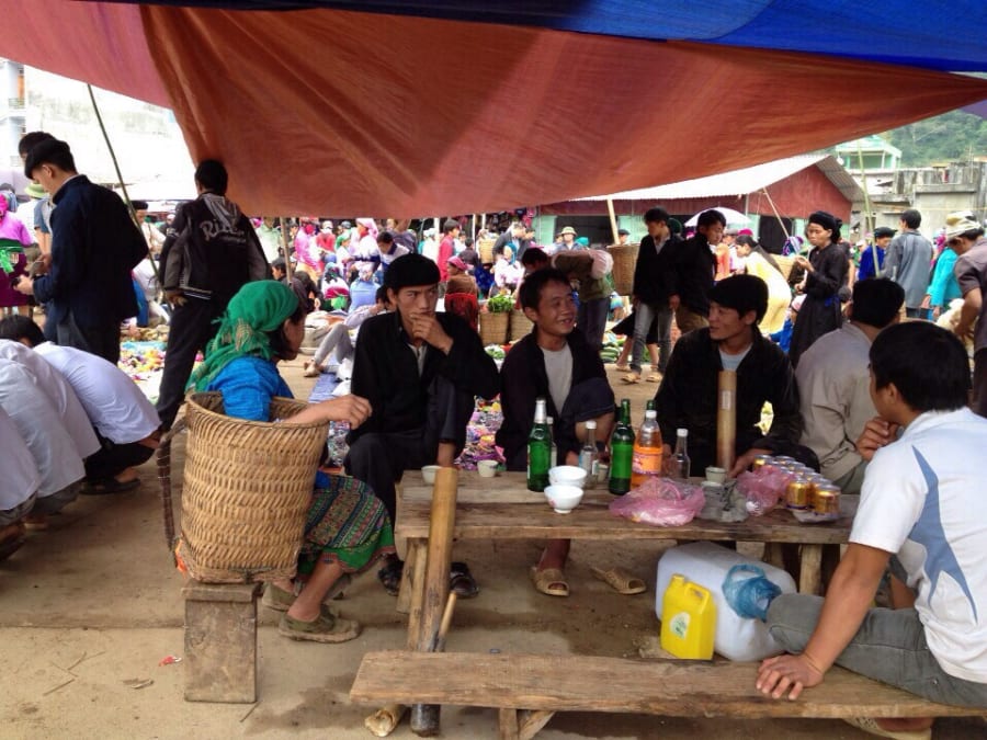
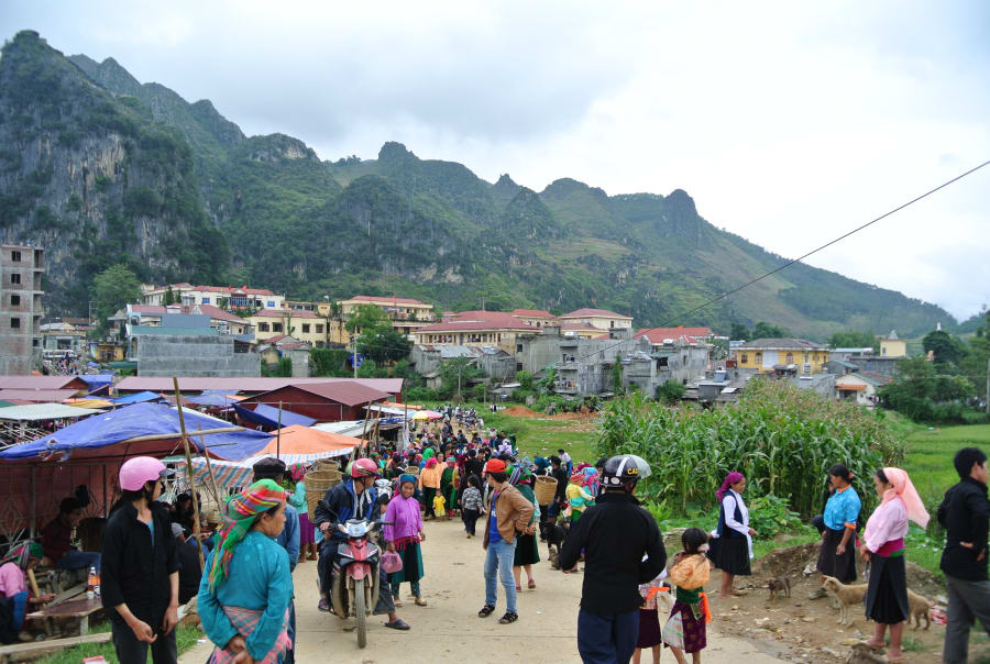
Ha Giang's Sunday markets - particularly Dong Van market and Meo Vac market - are the best places to experience local food culture. Ethnic minority groups including H'Mong, Tay, and Dao come down from surrounding villages to trade, and food stalls serve dishes rarely found elsewhere.
Timing the loop to catch a Sunday market at either location is highly recommended.
Money & Connectivity
Where are the ATMs, and how much cash should I bring?
ATMs exist in Ha Giang city, with a small number in Dong Van town. Beyond these two points, assume cash-only and no ATM access.
Recommended: withdraw enough cash in Ha Giang city before starting the loop to cover your entire trip. For a 4-day trip, 2-3 million VND (roughly $80-120 USD) per person is a reasonable baseline, more if staying in guesthouses rather than homestays.
Card payment is not accepted at most guesthouses, fuel stops, or food stalls on the loop.
Which mobile network has the best signal on the Ha Giang Loop?
Signal on the Ha Giang Loop is patchy by nature - mountain terrain blocks coverage in many valleys and on passes. No network provides consistent coverage throughout.
Viettel is generally considered the most reliable network in remote northern Vietnam. Mobifone performs reasonably in towns but drops more frequently in remote sections. Vietnamobile and Reddi are not recommended for this route.
Expect full signal loss in several sections. Download offline maps before leaving Ha Giang city - do not rely on real-time navigation.
Accommodation
Which towns should I sleep in along the loop?
The standard 4-day itinerary uses these overnight stops:
- Night 1: Quan Ba or Yen Minh
- Night 2: Dong Van
- Night 3: Meo Vac (or back toward Du Gia for an alternative route)
An alternative route incorporates Du Gia - a quieter, less-visited area with beautiful rice terraces and a more local atmosphere. Du Gia is worth adding if you have 5 days.
Do I need to book accommodation in advance?
During peak flower seasons (October-November and January-February), yes - book at least 3-5 days ahead, especially for Dong Van and Meo Vac. Popular homestays fill up weeks in advance during buckwheat season.
Off-peak, walk-in is generally fine except on weekends.
Safety & Reality
Is the Ha Giang Loop dangerous?
Honestly assessed: yes, relative to most tourist destinations in Southeast Asia. The loop has a higher accident rate than typical tourist routes, and fatalities occur every year - primarily from riders with insufficient experience on unfamiliar terrain.
The risks are real but manageable. The loop is completed safely by thousands of riders every year. The key factors that determine safety are: your riding experience, the condition of your bike, your speed choices, and your willingness to stop when conditions deteriorate.
The most common accidents involve: riding too fast on unfamiliar passes, attempting night riding, continuing through rain or fog, and riding under the influence of alcohol.
On corn wine and riding: Corn wine (rượu ngô) is offered generously at nearly every homestay and market. It's part of the culture and genuinely worth experiencing - but not the morning before a mountain pass.
Many current tours involve drinking every evening, sometimes heavily. The problem is cumulative: impaired judgment on day two or three of a multi-day ride, on roads that require full concentration, is how serious accidents happen.
This isn't theoretical. Riding after drinking on the way to Lung Cu is how I ended up on the ground at a corner - minor injuries, but a clear reminder that these roads don't forgive much. If your Easy Rider guide is drinking heavily the night before, that's also worth paying attention to. They're the one responsible for your safety.
What level of riding experience do I need?
At minimum, you should be comfortable riding a manual motorbike (xe số) before attempting the loop solo. This means: can shift gears smoothly, can brake confidently on downhills, and have experience with unpaved or rough road surfaces.
If you have only ridden automatic scooters before, hire an Easy Rider for the Ha Giang Loop specifically. The difference between an automatic and a manual gearbox matters significantly on steep mountain descents.
Experienced riders who ride regularly in Vietnam will find the loop challenging but manageable. First-time riders in Vietnam should not self-ride.
Is Ha Giang safe for solo female travelers?
Ha Giang is generally considered safe for solo female travelers. The region is relatively peaceful, locals are accustomed to foreign visitors, and the main loop towns have established guesthouse infrastructure.
Practical considerations:
- Riding solo as a woman draws attention in some villages - this is curiosity rather than hostility in most cases
- Stick to well-traveled sections of the loop and avoid riding after dark
- Stay at established guesthouses or homestays with reviews
- The Easy Rider option provides both safety and local guidance, which many solo female travelers prefer
The broader safety considerations that apply to all riders - road conditions, licensing, weather - are the primary risks, not personal security.
Do I need a special permit for the Ha Giang Loop?
Yes - technically required, and worth getting. The classic loop route passes through four districts that border China (Quan Ba, Yen Minh, Dong Van, Meo Vac), and foreign visitors are legally required to carry a border travel permit (Giấy phép vào khu vực biên giới) to enter these areas.
In practice, some riders complete the loop without one and never get stopped. But the risk isn't worth taking: police checkpoints are random and more frequent on weekends and holidays, and guesthouses inside the border districts may refuse to check you in without a permit.
Getting the permit is straightforward. Ask your hotel or guesthouse in Ha Giang city to arrange it the day before - most handle it on the same day. Alternatively, apply in person at the Immigration Office at 415A Tran Phu Street, Ha Giang City (open Mon-Sat, 8:00-11:30 and 13:30-16:30). You'll need your passport, visa details, and motorbike plate number if you've already rented. Cost is around 200,000-250,000 VND per person, processing takes 10-20 minutes, and the permit is valid for up to 30 days.
If you've already started the loop and forgot, riders report being able to apply in Dong Van town - ask your accommodation for the current office location.
A Final Note on Ma Pi Leng
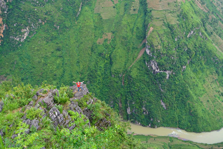
Standing at Ma Pi Leng, I was riding back from Dong Van with bruised hands and aching legs from a fall earlier that day - a reminder that these roads collect what you don't give them.
The pass you're riding today is part of the 185km Happiness Road (Đường Hạnh Phúc), carved entirely by hand between 1959 and 1965. Over 1,300 young volunteers from 8 provinces suspended themselves on ropes against these same cliffs for 11 months straight, drilling rock by hand, centimeter by centimeter, with almost no machinery. Fourteen of them never came home.
The views here are genuinely spectacular. But knowing what it took to build this road makes them mean something different.
For many riders, Ma Pi Leng ends up being the defining moment of their entire Vietnam trip - not just because of the scenery, but because a road this difficult to ride was also this difficult to build.