Overview
Gallery



About This Place
What Makes Mũi Sa Vĩ (Trà Cổ) Special
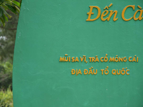
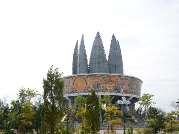
Mũi Sa Vĩ - also known as Mũi Gót - is the northeastern tip of Vietnam - the point where the country's coastline begins, the first mark on the S-shaped map, and the place that catches the mainland's first sunlight each morning. Located in Trà Cổ ward, Móng Cái, Quảng Ninh province, the cape sits where the Bắc Luân River meets the Gulf of Tonkin. At low tide, a long, winding sandbar resembling a dragon's tail is exposed near the shore here - widely cited as the origin of the name 'Sa Vĩ' (from the Sino-Vietnamese 沙 sa, 'sand', and 尾 vĩ, 'tail'). This is also where Vietnam's land border with China ends: border marker 1378, the final post along a roughly 1,406km frontier that begins at marker 0 near A Pa Chải in Điện Biên (at the tripoint where Vietnam, China, and Laos meet), sits on a small island - Hòn Dấu Gót, of which only about a third lies on the Vietnamese side, with China directly opposite - just offshore, in a river mouth here roughly 5km wide. The marker required unusual engineering to build: the islet's ground is soft enough that it submerges completely at high tide, so builders had to dig down to bedrock and construct a pedestal reportedly more than 10 metres tall just to keep the marker above the waterline. A relief sculpture of three phi lao pines carries a line from Tố Hữu, one of Vietnam's most celebrated modern poets: 'Từ Trà Cổ rừng dương đến Cà Mau rừng đước' - 'From Trà Cổ's casuarina forest to Cà Mau's mangroves' - a verse that compresses the entire length of Vietnam into a single image. For many Vietnamese travellers, touching this marker is a pilgrimage.
How to Get There
Getting There
Móng Cái is approximately 340-350km from Hanoi, reachable by sleeper bus (7–8 hours, ~250,000–300,000 VND) or by flying to Vân Đồn Airport and continuing by taxi or bus (about 1.5 hours). From Móng Cái city centre, Mũi Sa Vĩ is roughly 10-13km east - take a taxi, grab motorbike, or rent a motorbike for the short run. Trà Cổ Beach and Đình Trà Cổ are along the same road. Móng Cái is a popular overnight border-trade destination with plenty of hotels at all price points.
What to Expect
On the Ground
The entrance gate leads to a small landscaped area with the Km 0 coordinate marker, the three-pine relief sculpture, and a viewing terrace over the beach and estuary; a short walk of about 20 metres past the marker reaches the edge of the border zone itself. Offshore, the white-and-coloured post of border marker 1378 is visible on clear days, sitting on Hòn Dấu Gót - an islet that disappears underwater at high tide and reappears at low tide, when the connecting sandbar is exposed. The cape itself is low-lying - there's no dramatic cliff - but the symbolic weight of standing at the first point of Vietnam's coastline is palpable, especially at sunrise when the light comes in across a flat sea. Trà Cổ Beach, curving away to the south, is one of the longer sandy beaches in northern Vietnam and relatively calm and shallow, popular with Vietnamese families in summer.
Travel Tips
Tips
It's worth being upfront about what this place actually offers: Mũi Sa Vĩ is significant for its symbolism and sovereignty history far more than for natural scenery, good food, or striking architecture on-site - if that's what you're after, this specific spot isn't it, though the wider Trà Cổ area does have more to offer nearby. Mũi Sa Vĩ pairs naturally with the rest of the Móng Cái experience: the border town has a lively Chinese-goods market, fresh seafood restaurants, and a distinct cross-border energy unlike anywhere else in Vietnam. Nearby, Nhà Thờ Trà Cổ - a 19th-century Gothic-style church covering more than 12,000 square metres, with a bell over 80 years old - is a substantial architectural stop most visitors miss, alongside Đình Trà Cổ (whose festival runs around the end of the 5th lunar month, drawing crowds for traditional coastal rituals). Combine it with nearby Vĩnh Thực Island (home to a historic French-era lighthouse) for a fuller Quảng Ninh borderland trip. Trà Cổ Beach itself varies with the season - water clarity isn't consistent, and it's sometimes too murky for swimming - and accommodation directly in Trà Cổ remains fairly limited, so many Vietnamese visitors treat it as a day trip and sleep back in Móng Cái city. If you're doing a full northeast Vietnam loop, Mũi Sa Vĩ makes a logical starting or ending point before continuing south along the coast toward Hạ Long Bay.
Insider Tips
Based on real traveler experiences and commonly mentioned advice from multiple visitors.
FAQ
Common questions from travelers who've visited this place.
What is special about this location?›
How much time should I spend here?›
Can I visit border marker 1378 itself?›
Nearby Locations
Explore more things to do like this around Vietnam