Menu
Destinations→Locations→Blog→Map→About→
Mountain

Nhiu Co San Mountain

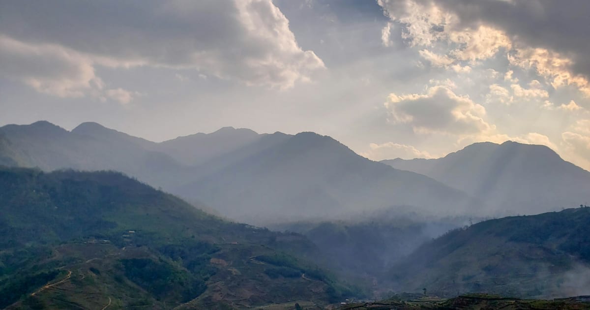
Nhiu Co San (Sừng Trâu, the Buffalo Horn) is one of Vietnam's highest peaks at about 2,965 m in Bát Xát, Lào Cai - a 2 days 1 night trek past the Ong Chúa waterfall and through primeval forest to a summit famous for sunrise and cloud seas.

Ong Chúa Waterfall · Cloud Sea & Sunrise · One of Vietnam's Highest Peaks

Nhiu Co San Mountain
Best time to visit
Sep - May is the trekking season, with the best chances of a cloud sea and Ong Chúa waterfall running well. Sep - Oct is when the waterfall carries the most water and the goat pasture is at its greenest. Oct - Mar usually brings the clearest, driest weather. In winter cold snaps the mountain can freeze, coating leaves and branches in ice like glass - beautiful, but bitterly cold and slippery. Spring brings red and yellow rhododendrons in the old forest and peach and plum blossom lower down, and maples change colour in autumn. Jun - Aug is the rainy season, when the access road and trail are at their muddiest and most slippery.
Best time of day
Leave the hut around 4 AM to reach the summit by about 6 AM for sunrise and the cloud sea. If you're running late, stop in the bamboo forest below the moss forest - the cloud-sea view is clearer there than from inside the trees. Arrive at the hut early on day 1 to catch sunset.
Entry fee
No entrance fee. Guided tours cost around 2,700,000-4,000,000 VND per person (2026 price) with operators such as Tổ Ong Adventure, Viettrekking and Travel Up. One group organising everything themselves with a local porter reported spending around 1,900,000 VND per person. Check current prices before booking.
Opening hours
No fixed hours. Treks are arranged with local porters or tour operators.
Address
Nhìu Cồ San village, Dền Sáng, Lào Cai (formerly Bát Xát district, Lào Cai)
Crowds
Moderately popular; the shared hut area can fill up at weekends
Difficulty
Moderate (about 5/10): roughly 20 km round trip, about 90% uphill on the way in, with high steps after the waterfall and long, knee-punishing descents
Safety
No phone signal or electricity. The trail and the access track are slippery in rain. Snakes have been seen on the trail
Accessibility
Not accessible for visitors with limited mobility. The xe ôm track to the trailhead is very rough
Seasonal
Sep - May; Sep - Oct for the fullest waterfall, Oct - Mar for the clearest skies, spring for rhododendrons

What Makes Nhiu Co San Mountain Special

Nhiu Co San rises to about 2,965 m in the Hoàng Liên Sơn range, in the Bát Xát area of Lào Cai. It is usually listed ninth among Vietnam's highest peaks, after Fansipan, Pu Si Lung, Pu Ta Leng, Ky Quan San, Khang Su Van, Ta Lien Son, Ta Chi Nhu and Po Ma Lung.

It is also called Sừng Trâu (Buffalo Horn), after its Hmông name: from a distance the mountain shows two peaks curving up like a giant pair of buffalo horns, which has earned it the nickname "buffalo king of the northwest". In the Hà Nhì language, Nhìu Cồ San is said to mean "three big mountains".

Ong Chúa Waterfall and Changing Landscapes

Ong Chúa (Queen Bee) waterfall is the symbol of Nhiu Co San. It drops from a cliff hundreds of metres high - not a powerful torrent but thin white streams spilling over tiers of old mossy rock, said to look like bees beating their wings in the forest. Around it, the landscape keeps changing: Hmông villages and fields at the bottom, low hills with shrubs, grassland and cliffs, then primeval forest with huge trees, red ferns, cardamom, lichens and maples that turn gold in autumn, and finally bamboo and moss forest near the summit, where old rhododendrons flower in spring.

How to Get to Nhiu Co San Mountain

Most trekkers take a sleeper bus from Hanoi at around 10 PM, arriving in Lào Cai city at 3-4 AM. A local bus at about 5:30 AM reaches the Dền Sáng junction around 7:30-8 AM, where porters usually meet their groups. Some small groups ride their own motorbikes to the junction instead - cheaper, but cold, foggy and full of potholes, with visibility sometimes down to a few metres on the way back after dark. Several sections of road from Lào Cai were badly damaged by Typhoon Yagi.

From the junction, a local xe ôm covers the last 7-8 km to Nhìu Cồ San village on a mountain track strewn with huge rocks. It's become a trademark of the trip - many trekkers joke that the xe ôm ride is scarier than the climb - and it gets slippery in the rainy season.

What to Expect on the Nhiu Co San Mountain Trek

Nhiu Co San is usually rated "not too hard, not too easy" - about 5/10, doable for beginners who have trained, though steeper and rockier than easier peaks such as Lảo Thẩn. Sources put the round trip at roughly 17-22 km, so plan for about 20 km, around 90% of it uphill on the way in. Day 1 is usually 5-6 hours from the village to the huts at around 2,500 m. On day 2 you climb before dawn, about 1.5-2 hours along a stream and through ghostly moss forest, to the summit for sunrise, then descend.

Two Routes: Ong Chúa Waterfall and the Goat Pasture

The Ong Chúa waterfall route runs through forest with rich plant life, streams and wooden bridges. The walk from the village to the waterfall along the forest edge is fairly gentle; the steepest climbing, with big high steps, starts after the waterfall, and legs often feel it after lunch there. The goat pasture route (Bãi Dê) crosses open, bare hills with little shade but wide views over the valley and villages.

Accounts of it differ: some find it gentle with few views, others find the continuous descent the hardest part on the knees, especially in the rain. Many groups go up via the waterfall and down via the goat pasture.

Huts, Sunrise and the Summit

Both routes share one hut area about 1.5 hours below the summit, so space can run short at busy times. Sunrise is visible from the huts, but the summit blocks the sunset there. On top, the summit is open with a decent 360-degree view, and on a good morning you look out over a sea of cloud drifting between the ranges. There's no phone signal or electricity on the mountain, nights are cold, and clear nights are excellent for stars.

Honest take

The waterfall is the real highlight. Some trekkers say that apart from Ong Chúa there isn't much mountain view, and that the vegetation is less varied than on Ky Quan San. Cloud seas are never guaranteed - one group got only about 30% cloud cover, though that meant clear views of the valleys below.

Travel Tips for Nhiu Co San Mountain

Tours cost around 2,700,000-4,000,000 VND per person (2026) with operators such as Tổ Ong Adventure, Viettrekking and Travel Up. Foreign visitors may face additional entry requirements because the route is in a restricted border area - confirm with an established operator well before your trip. Porters from Sàng Ma Sáo carry the heavy bags and are often praised for their cooking.

  • Grippy trekking shoes, a comfortable backpack and comfortable clothes
  • Light snacks and water for the day; porters carry the heavy loads
  • Knee braces and trekking poles for the descents
  • Warm layers - it's very cold at night, especially in winter
  • A power bank, since there's no electricity on the mountain
  • If you've never trekked before, train seriously first or try an easier 2 days 1 night peak
Pace yourself

Climb slowly and steadily, taking very short rests when you need them rather than long stops. It's the easiest way to avoid running out of energy halfway up.

Based on real traveler experiences and commonly mentioned advice from multiple visitors.

  • Go up via Ong Chúa waterfall and down via the goat pasture
  • Start at 4 AM on summit day for sunrise
  • Check Windy and AccuWeather before you go, and avoid humid or rainy forecasts
  • Time needed: 2 days 1 night on the mountain - plus the overnight bus from Hanoi, so most people count it as 2 days 3 nights door to door
  • Classic plan: go up via Ong Chúa waterfall (forest, streams, the waterfall itself) and come down via the goat pasture (Bãi Dê) for open views over the valley and villages
  • Leave the hut at about 4 AM to reach the summit around 6 AM for sunrise; if you're late, stop in the bamboo forest for a clearer cloud-sea view
  • There's no phone signal and no electricity on the trek - sort out work beforehand and bring a power bank
  • Bring knee braces and trekking poles: the trail is about 90% uphill on the way in, and the long descents are hard on knees and toes. In the rain, sliding down sitting is sometimes the safest option on the steepest parts
  • Check the weather before you go: on Windy, look for sun and low cloud under about 40%; on AccuWeather, a morning forecast of "Clear" or "Partly Sunny"; avoid days with humidity over about 80% or rain
  • For stargazing from the hut, go near the new moon (the 1st of the lunar month), when the sky is darkest and the Milky Way is clearest
  • There's only one hut area shared by both routes, so it can run short of space - go on a weekday if you can
  • Watch where you step: trekkers have met colourful snakes on the trail even in September
  • The ride from the main road to the trailhead is on a terrible rocky track - take a local xe ôm rather than your own bike
  • First-timers should hire a porter and train beforehand with walking and skipping; experienced trekkers will find it a fair 5/10 challenge

Common questions from travelers who've visited this place.

Is there phone signal or electricity on Nhiu Co San?
No. There's no phone signal and no electricity on the trek, so sort out work beforehand and bring a power bank - and enjoy a couple of days offline in the forest.
Can foreigners trek Nhiu Co San?
Foreign visitors may face additional entry requirements because the trekking route is in a restricted border area. Contact an established tour operator well before your trip to confirm whether a permit is required and who will arrange it.
How long does it take to climb Nhiu Co San?
2 days 1 night on the mountain: about 5-6 hours to the huts on day 1, then a pre-dawn climb of about 1.5-2 hours to the summit and the descent on day 2. With the overnight bus from Hanoi, most people count it as 2 days 3 nights.
Is Nhiu Co San suitable for beginners?
Yes, if you train beforehand. It is usually rated "not too hard, not too easy", though it is steeper and rockier than easier peaks like Lảo Thẩn, and the descents are hard on the knees.
Which route should I take?
The Ong Chúa waterfall route has the forest and the waterfall but is steeper and longer; the goat pasture route is open, with wide valley views but little shade. Most groups go up via the waterfall and down via the goat pasture.
Why is it called Sừng Trâu (Buffalo Horn)?
In Hmông, the name refers to the mountain's shape: from a distance it has two peaks that curve up like a giant pair of buffalo horns.

Explore more things to do like this around Vietnam