There is no simple way to understand the Vietnam War.
The conflict lasted for roughly two decades, and its battlefield was far larger than Vietnam alone. Fighting and military operations extended across Vietnam, into Laos and Cambodia, and across the surrounding seas and airspace.
So this article is deliberately a simplification.
Not because the history was simple, but because a traveler has limited time.
If you have a month - or less - to travel through Vietnam and want to understand something about the war beyond the usual museums and famous photographs, where should you start?
You could spend weeks following individual battles, campaigns and military operations.
Or you could start with three places that are relatively accessible to travelers and together provide three very different perspectives on the conflict:
Hanoi. Quảng Trị. Saigon.
The North. The Battlefield. The South.
This is not an attempt to tell the whole story in three stops.
It is a way to make a very complicated war easier to see on the map - and easier to understand while traveling through Vietnam.
These three places also make geographic sense. Hanoi is the political and military center of the North; Quảng Trị sits in one of the most heavily contested parts of central Vietnam; and Saigon was the political center of South Vietnam and the setting for the final chapter of the war.
These are not the "most important" three places to visit. They are particularly practical and revealing starting points for a traveler with limited time.
- HanoiLook UpCommand center · Air war
- Quảng TrịLook Up → Look DownFrontline · Underground world
- SaigonLook DownUrban conflict · Hidden battlefield
1. Hanoi - Understanding the North
Start in Hanoi.
For much of the war, Hanoi was the political and military center of North Vietnam. Today, several places around the city allow travelers to approach the war from very different directions.
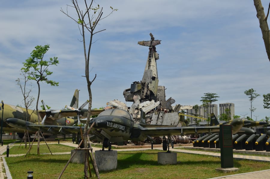
At the Vietnam Military History Museum, you can see the conflict through military history, weapons, aircraft and other artifacts.
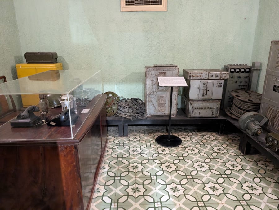
At D67 and the Thăng Long Imperial Citadel, the story moves closer to military command and decision-making.
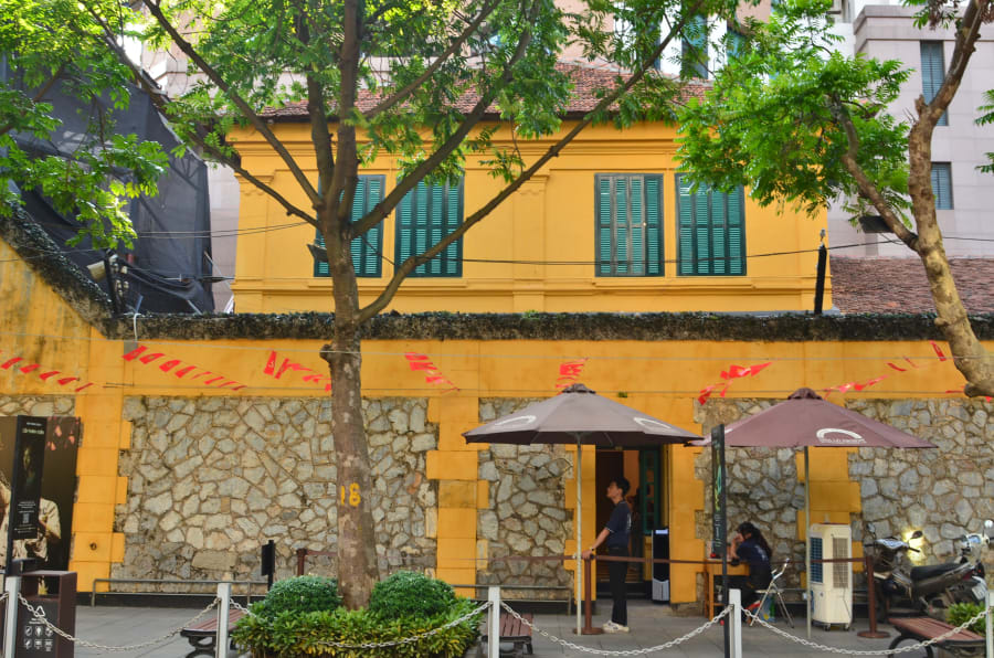
At Hỏa Lò Prison, the history becomes more complicated. The site predates the Vietnam War by decades, having been built during the French colonial period, but it later became associated with American prisoners of war. The meaning of the same place can shift entirely, depending on where the visitor standing at its gates comes from.
And then there are the traces of a very different kind of battlefield.
The sky.
2. Look Up - The War From Above
One of the most striking reminders of the war in Hanoi is the wreckage of a B-52.
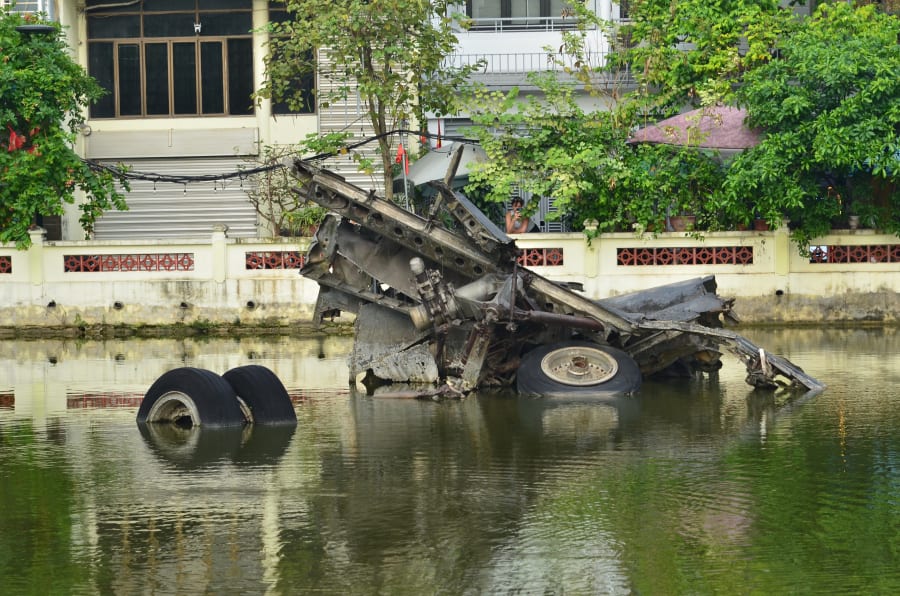
It immediately changes the way you imagine the conflict.
Instead of soldiers moving through a jungle, the battlefield is suddenly thousands of meters above the ground.
During Operation Linebacker II in December 1972, B-52 bombers and tactical aircraft conducted an intensive bombing campaign against targets in and around Hanoi and Haiphong. U.S. archival documents describe the operation as a maximum-effort campaign against selected military targets, while later military histories record 729 completed B-52 sorties and over 15,000 tons of bombs dropped in just 11 nights.
For a traveler standing beside the remains of a B-52, the important thing is not memorizing the numbers.
It is understanding the scale.
This was a form of warfare in which enormous destructive power could be delivered from far above the battlefield.
Look up.
The war could come from the sky.
And then you can travel south.
Because eventually, the war comes back down to the ground.
3. Quảng Trị - Where the War Reached the Ground
If Hanoi lets you see the war from the perspective of a capital under attack from the air, Quảng Trị brings you directly into the battlefield.
Few places in Vietnam make the geography of the war so visible.
The province sat near the 17th parallel, where the Hiền Lương - Bến Hải area became associated with the division of Vietnam after the Geneva settlement. Here, geography itself became history.
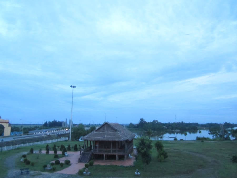
The Quảng Trị Citadel brings you into one of the most intense battles of 1972. The 81-day battle for the citadel (June 28 - September 16, 1972) became one of the most intense episodes of the war. The city and surrounding areas suffered extensive destruction.
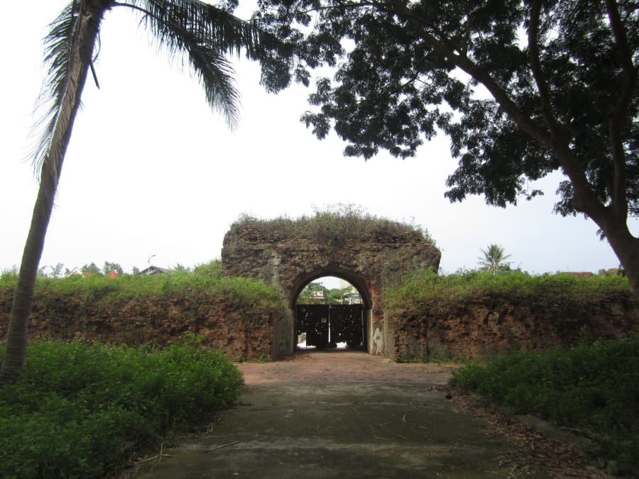
In Hanoi, you see the machinery of a strategic air campaign. Here, you can imagine what happened when that enormous firepower reached a battlefield where people were fighting on the ground. The war was no longer somewhere in the sky. It was happening all around you.
Then do something completely different.
Look down.
At Vĩnh Mốc, the story moves underground. The Vĩnh Mốc tunnel system was built by local people and used as an underground environment for shelter and daily life during the war.
The contrast is extraordinary.
Above ground: bombs, artillery, aircraft.
Below ground: people, families, shelters, daily life.
When the surface became dangerous, people created another world beneath it. And suddenly the Vietnam War is no longer just a story about armies. It becomes a story about how civilians adapted to survive inside a battlefield.
This is why Quảng Trị is the hinge of this journey. You can literally experience the war in two directions: look up, then look down.
Quảng Trị Citadel - Look up. A battlefield exposed to enormous firepower.
Vĩnh Mốc - Look down. A community adapting to life beneath that battlefield.
The contrast gives you something that a museum display alone cannot easily provide. The war had a vertical dimension: there was the sky, there was the battlefield, and there was the underground world built beneath it.
Further west, Khe Sanh opens another chapter of the conflict in the mountains.
Before you leave Quảng Trị, visit the Trường Sơn National Martyrs Cemetery.
Here, you no longer need to look up at the sky or down into the earth. Look straight ahead, at more than ten thousand graves commemorating those who died during the war in the Trường Sơn region.
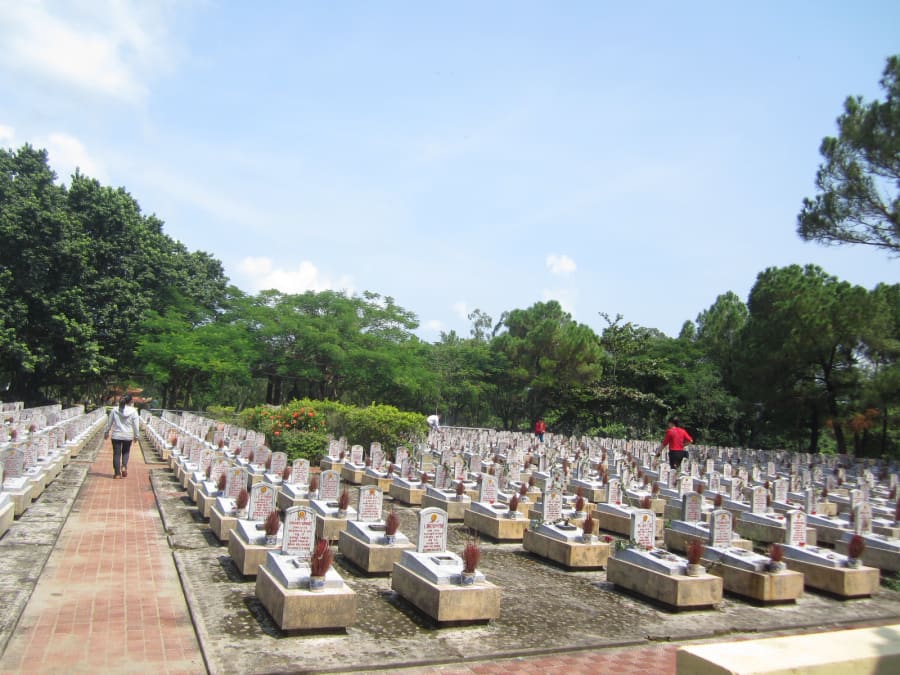
Standing among those graves, the numbers from earlier - 729 sorties, over 15,000 tons of bombs - suddenly take on a different shape. They are no longer military statistics. They are names carved into headstones, many of which carry no birth date, or no name at all.
4. Saigon - Understanding the South
Continue south and the story changes again.
Saigon was the political center of South Vietnam and a major center of American military and political presence.
If Hanoi helps you understand the North, Saigon gives you another perspective on the conflict.
Start at Independence Palace.
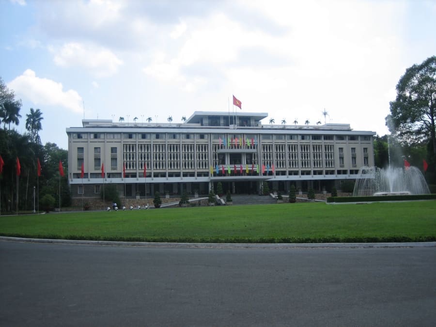
Then visit the War Remnants Museum, which presents the war and its consequences from a Vietnamese perspective.
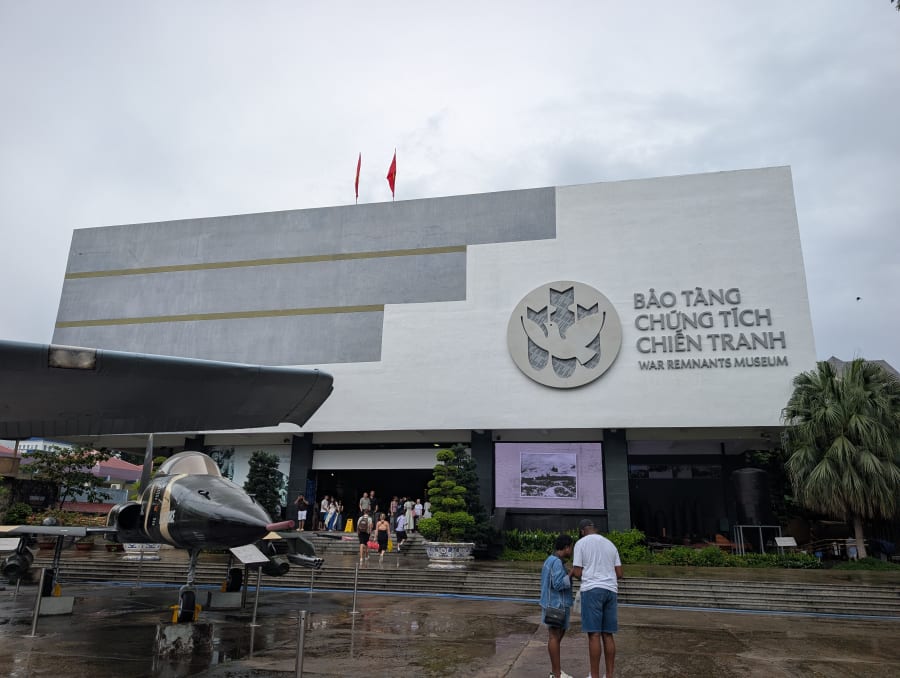
But the most interesting part of this chapter may lie outside the city center. Because around Saigon, the battlefield could become surprisingly difficult to see.
Sometimes, you had to look down.
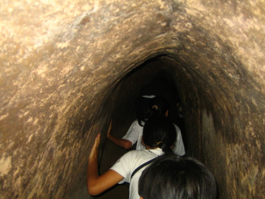
The Củ Chi Tunnels are perhaps the most famous example. Beneath the countryside north of Saigon was an extensive underground network associated with Viet Cong forces. Tunnels allowed people to hide, move, organize activities and maintain bases close to one of the most important cities in South Vietnam.
Then there is Rừng Sác. The mangrove forests and waterways southeast of Saigon created a very different kind of battlefield. Here, dense vegetation and waterways became part of a guerrilla environment remarkably close to the city and its approaches.
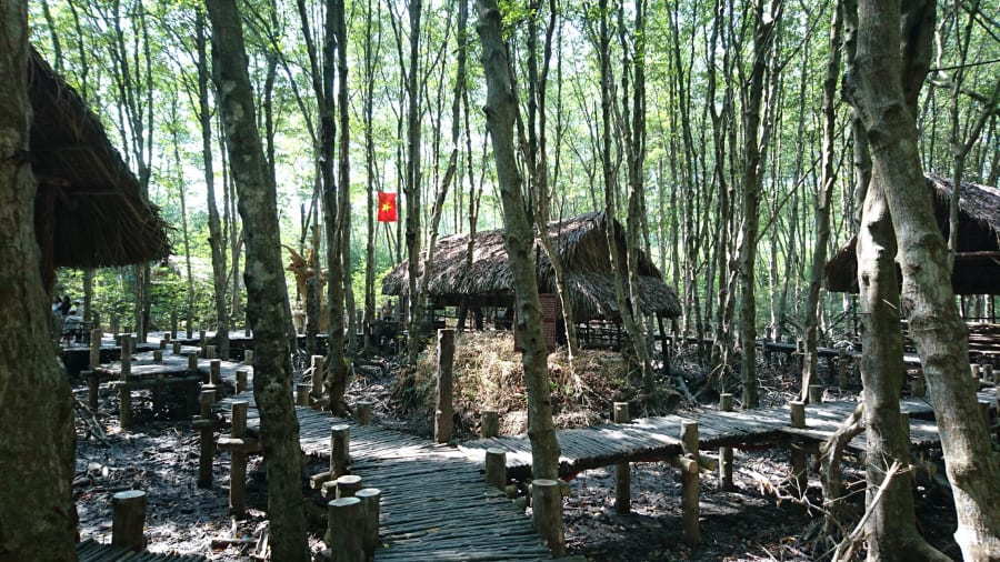
This was not a battlefield that always announced itself. It could be hidden. It could move. It could disappear into the landscape.
Around Saigon, the war was sometimes beneath your feet, behind the trees, or just beyond the road.
And sometimes, it is still there today.
In June 2026, the military began excavating Lê Thị Riêng Park - a large, familiar park where city residents have exercised, walked, and played sports for decades. The area was once an old city cemetery. By mid-September, authorities had recovered more than 640 sets of remains believed to be fallen soldiers, with search efforts pausing as the city prepared a memorial and reburial ceremony in early October.
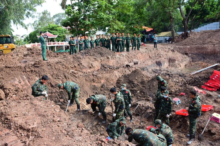
This is not a story from 50 years ago. It is happening right now, as you read this. In the same way Củ Chi and Rừng Sác show how a battlefield can hide in plain sight, Lê Thị Riêng shows that the same is still true today: the war does not only live in museums or in distant battlefields. Sometimes, it lies beneath a park you may have walked through without ever knowing.
Don't turn this into "the North was an air war, the South was a guerrilla war." The actual war was far more complicated - both sides used many different forms of warfare at different times and places, including conventional ground operations, artillery, air power, guerrilla warfare, intelligence, logistics and urban combat. The three places in this article are not meant to divide the entire war into three neat boxes. They are windows. Hanoi gives you one window. Quảng Trị gives you another. Saigon gives you another. Together, they show how differently the war could be experienced depending on where you stood.
5. Three Places. Three Ways of Seeing the War.
Now put everything together.
HANOI - The North - Look Up ✈️ B-52s · ✈️ Air power · 🏛️ Political and military center
QUẢNG TRỊ - The Battlefield - Look Up → Look Down 💥 Quảng Trị Citadel → 🕳️ Vĩnh Mốc → a battlefield above, a world beneath it
SAIGON - The South - Look Down 🕳️ Củ Chi · 🌿 Rừng Sác · 🏙️ Guerrilla warfare close to a major urban center
None of these places tells the whole story.
But together, they give you something valuable: a mental map.
6. Vietnam's Geography Is Part of the Story
One of the easiest ways for a traveler to misunderstand the Vietnam War is to think of it as one giant battlefield.
It wasn't. In Hanoi, you are in a capital city. In Quảng Trị, you move through a narrow region shaped by mountains, rivers, the coast and the former dividing line. At Củ Chi, the landscape changes again. At Rừng Sác, mangrove forests and waterways become part of the story.
The war moved through: cities → countryside → mountains → jungle → rivers → tunnels → skies.
Vietnam's geography did not simply provide the backdrop. It shaped how the war was fought and experienced.
7. If You Want to Explore the Vietnam War While Traveling
You don't need to visit every military museum and battlefield in Vietnam.
Instead, think of these three regions as starting points.
In Hanoi - Visit: Vietnam Military History Museum · Hỏa Lò Prison · D67 / Thăng Long Citadel · B-52-related sites Think: The North. The capital. The war from above.
In Quảng Trị - Visit: Hiền Lương - Bến Hải · Quảng Trị Citadel · Vĩnh Mốc Tunnels · Khe Sanh · Trường Sơn National Martyrs Cemetery Think: The battlefield. Above ground and below it.
Huế is a convenient base for travelers who want to explore Quảng Trị's DMZ sites as day trips.
In Saigon - Visit: Independence Palace · War Remnants Museum · Củ Chi Tunnels · Rừng Sác Think: The South. The city. The hidden battlefield around it.
And this is where SoloInVietnam's individual location pages become useful. This article answers: why does this place matter? The location pages answer: how do I get there? When should I go? What does it look like? How long should I spend there? What should I know before visiting?
If these three places aren't enough, the war left traces in many other places worth exploring further - from Huế and the urban battle of the Tết Offensive, to Sơn Mỹ, the Central Highlands, or the waterways of the Mekong Delta. Those are stories for another time.
8. Before You Visit, Learn How to Look
The Vietnam War is often introduced through familiar images: aircraft, soldiers, jungles, tunnels, bombs, and ruined buildings.
But traveling through Vietnam allows you to see those pieces from very different perspectives.
In Hanoi, look up. In Quảng Trị, look up - then look down. Around Saigon, look down.
You will not see the entire war this way.
But you may begin to understand something more important: the war did not look the same everywhere. It changed with the geography. It changed with the people. It changed with the military environment.
And the story is not entirely closed. Across Vietnam, there are still people who died in the war and have never been found. They lie somewhere beneath forests, hillsides, rivers, or even the urban spaces where a later generation now lives.
By history's account, the war ended in 1975.
But for many Vietnamese, the wounds, the losses, and the grief have lasted far longer. Vietnam needed twenty years to end the war - but it may take several more generations to heal from it.
Three places. Three perspectives. One starting point for understanding the Vietnam War.