Menu
DestinationsLocationsBlogMapAbout
mountain · nature · landmark

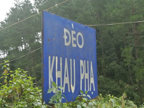
Khau Phạ Pass

Khau Phạ Pass is one of Vietnam's four great mountain passes - a 30km road through the clouds between Tú Lệ and Mù Cang Chải, with the most dramatic views of rice terraces in the country, and the only paragliding launch site in the entire Mù Cang Chải region.

One of Vietnam's Four Great PassesRice Terrace ViewsParaglidingPhotography
Get Directions
Best Time to Visit
Early morning for the clearest views before cloud builds over the summit
Entry Fee
Free (the pass itself); tandem paragliding is a separate paid activity, with sources citing anywhere from around 1,500,000 to 2,190,000 VND per flight depending on operator and season
Opening Hours
Open daily; road occasionally closed after heavy rain or landslide
Address
Tú Lệ - Mù Cang Chải, Văn Chấn, Yên Bái
Difficulty
Numerous sharp bends make driving challenging; especially dangerous in fog with no barriers or warning signs
Safety
Road deteriorated from lack of maintenance; falling stones from mountains possible; weak red basalt soil foundation causes erosion
Seasonal
Fog frequently affects the summit area, presenting hazards for drivers

What Makes Khau Phạ Pass Special

Khau Phạ Pass is ranked among Vietnam's tứ đại đỉnh đèo - the four great mountain passes - alongside Ô Quy Hồ, Pha Đin, and Mã Pí Lèng, and is sometimes also called Đèo Cao Phạ locally. At approximately 1,200-1,268m above sea level, it crosses the Hoàng Liên Sơn range between Tú Lệ valley in Văn Chấn district and the Mù Cang Chải plateau in Yên Bái province, covering about 30km of mountain road through terrain that drops several hundred meters on both sides. The name Khau Phạ means 'Horn of the Sky' in the local Thái language - a name that describes the cloud-shrouded summit accurately. The pass is the gateway to Mù Cang Chải, which holds Vietnam's most photographed rice terraces, and the descent toward those terraces from the pass summit is one of the most celebrated stretches of road in the country. Beyond the drive itself, the summit is also the only paragliding launch site in the whole Mù Cang Chải region.

Getting There

Khau Phạ Pass connects Nghĩa Lộ and Tú Lệ to the east with Mù Cang Chải to the west, on National Highway 32. From Hanoi, the standard route is Highway 32 west through Sơn Tây and Nghĩa Lộ to Tú Lệ - approximately 280km, taking 6-7 hours by motorbike or 5-6 hours by car. Tú Lệ is the last town with fuel, food, and accommodation before the pass. From the west, Mù Cang Chải town is the base for the Mù Cang Chải rice terrace area and sits at the foot of the pass on the western side. The pass is an integral part of the Mù Cang Chải motorbike circuit from Hanoi.

On the Ground

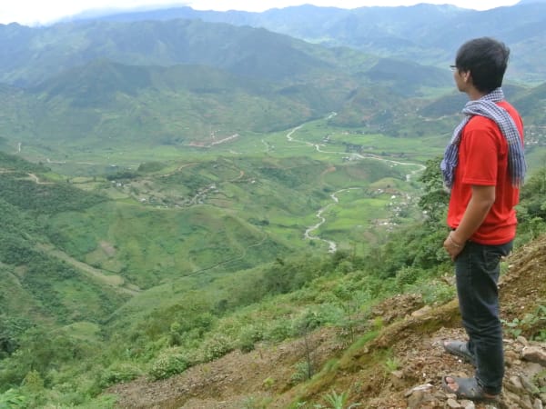
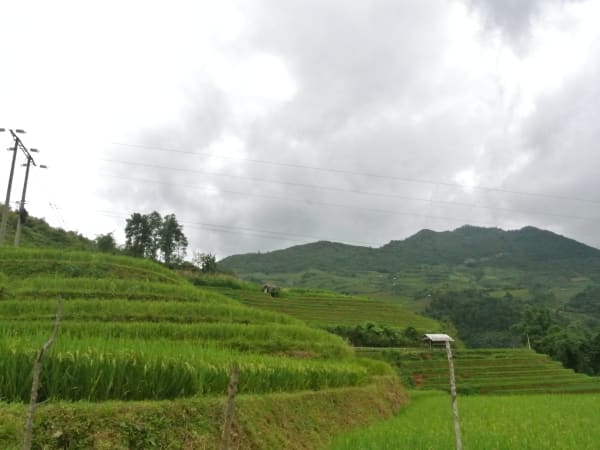
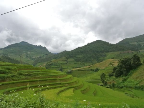
The road climbs through dense forest on the eastern approach from Tú Lệ, breaking into open views as it nears the summit. At the top, on clear days, the rice terraces of Mù Cang Chải's La Pán Tẩn and Chế Cu Nha communes are visible cascading down the western slopes - the full panoramic view that appears on most Mù Cang Chải photography. The descent toward Mù Cang Chải is the most spectacular section: switchbacks dropping through terraced fields with the valley floor far below. The road is paved throughout but requires full attention - truck traffic, motorbikes, and the occasional landslide debris demand steady riding. Roadside viewpoints have developed organically at the best vantage points. At the summit, a dedicated paragliding launch point operates tandem flights over Lìm Mông valley, and during peak season the sight of paragliders launching against the terraced backdrop is itself part of the pass's appeal, whether or not you fly yourself.

Tips

Khau Phạ is not just a road to Mù Cang Chải - it is itself one of the defining experiences of the northern Vietnam motorbike circuit. The combination of the Tú Lệ approach through valley farmland, the forest climb to the pass, and the vertiginous descent into the terrace landscape below is a sequence that most riders remember as one of the best half-days of riding in Vietnam. If you're doing the northwest loop from Hanoi - Nghĩa Lộ, Mù Cang Chải, Tú Lệ, Sơn La, Điện Biên - Khau Phạ is the highlight of the eastern leg. Allocate the whole day for Tú Lệ to Mù Cang Chải rather than treating it as a transit stage, and if paragliding interests you, book with a specialist operator in advance rather than hoping to arrange it on the spot, especially during the harvest season festival window.

Based on real traveler experiences and commonly mentioned advice from multiple visitors.

Stop at viewpoint approximately 1km beyond Google pin (heading north) for exceptional photo opportunities
Food stalls available along the pass; plan meals accordingly
Exercise extreme caution when driving in foggy conditions due to sharp bends and lack of safety barriers
The pass is most dramatic from the Tú Lệ side approaching west toward Mù Cang Chải - plan your direction of travel to ascend from the east for the best unfolding views
The summit area around 1,200-1,268m is frequently in cloud from late morning - start early to have the best chance of clear views over the terraces below
Tú Lệ village at the eastern foot of the pass is famous for sticky rice (xôi nếp Tú Lệ) and hot springs - worth an overnight stop rather than treating the pass as a transit point
The road surface is paved but narrow with sharp bends and occasional rockfall debris - ride at a pace that allows stopping for hazards, not just photos
September to October is peak season and the road has significant motorbike traffic on weekends - weekday riding gives a completely different, quieter experience
Avoid the June-August rainy season specifically if possible - slippery roads and landslide risk are more common in this window, on top of the general fog/erosion hazards present year-round
Never attempt to cross the pass after dark - riders consistently recommend starting by 5-6 AM and completing the crossing well before nightfall
This is the only paragliding launch site in the entire Mù Cang Chải region. Tandem flights launch from around 1,268m and reach up to 2,000m, lasting 10-15 minutes over Lìm Mông valley - book ahead through a specialist operator, especially during the September-October harvest season and the 'Bay trên mùa vàng' ('Flying over the golden season') festival held here
The paragliding launch point is roughly 23km from Garrya Mù Cang Chải and about 20km from Đồi Mâm Xôi (Mâm Xôi Hill) if you're planning a combined day out
One of the most popular unofficial viewpoints is found via Trạm Y Tế Cao Phạ (Cao Phạ health station) near the base of the pass - park in the nearby lot, then take the trail opposite the station uphill for about 200-300m to reach a viewpoint over the valley. This is an informal, well-worn path rather than a proper trail - it can be steep and slippery, especially when wet, and falls have been reported, so wear shoes with good grip and take it slowly. Some angles near the top pass through grazing land, so watch your step and consider shooting from slightly higher or further back to avoid cattle mess in frame
Prefer a manual/clutch motorbike over an automatic for better control on the curves and climbs, and check your brakes, tires, and oil before setting out - maintain a steady 30-50 km/h on the pass itself and use low gear on the descents
Crossing the pass alone typically takes 1.5-2 hours; budget around 1.5 hours total if you're just driving through, or up to 3 hours if you're also doing the paragliding experience

Common questions from travelers who've visited this place.

Is the pass safe to drive in all weather conditions?
No. Fog significantly increases danger due to sharp bends, missing barriers, and falling stones. Road maintenance is poor with eroded sections.
Where should I stop for the best views?
Stop approximately 1km beyond the Google Maps pin when heading north for incredible panoramic views and photo opportunities.
Can I go paragliding at Khau Phạ?
Yes - the summit is the only paragliding launch site in the Mù Cang Chải region, with tandem flights (around 2,190,000 VND per flight as of recent 2026 pricing) launching from roughly 1,268m and reaching up to 2,000m over Lìm Mông valley. Book ahead through a specialist operator, especially during the September-October harvest festival season.