Menu
DestinationsLocationsBlogMapAbout
nature · mountain · ha giang loop

Quản Bạ Heaven Gate

Quản Bạ Heaven Gate is the first dramatic viewpoint on the Ha Giang Loop - a mountain pass at 1,500 metres where the road crests and the entire Quản Bạ (Tam Sơn) Valley opens below, with the Twin Mountains rising from the valley floor and, in the right season, a sea of clouds filling the basin at dawn.

Ha Giang Loop GatewayPanoramic ViewsGateway to the Karst PlateauCloud Valley
Get Directions
Best Time to Visit
6-9 AM gives the best odds of the cloud sea and sunrise light; if fog is heavy that morning, waiting until it burns off (later morning, closer to midday) can actually give clearer general views of the valley instead
Entry Fee
Free
Opening Hours
Open 24/7
Address
Quyết Tiến, Quản Bạ, Hà Giang
Crowds
Often very busy with tour groups and motorbikes, especially during peak season and mid-morning. Crossing the road and climbing the stairs leads to a noticeably less crowded vantage point
Difficulty
The road itself is steep and winding but well-paved. The stairs to the upper viewpoint number close to 100 and get steeper and less even toward the top
Safety
The mountain road can have gravel or repair sections at times, and gets heavy traffic from buses, trucks, cars, and motorbikes on a route with steep cliffs and drop-offs - take care around larger vehicles on the bends
Accessibility
Accessible by motorbike or car via Highway 4C. No entry fee or parking charge
Seasonal
Early morning or late afternoon offers the best light. It can be cold and windy at this elevation, so bring warm clothing regardless of season

What Makes Quản Bạ Heaven Gate Special

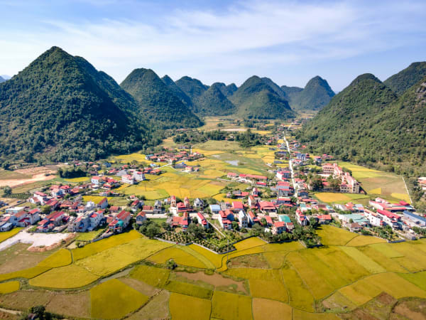
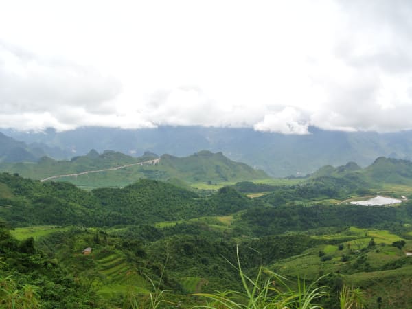
Quản Bạ Heaven Gate - Cổng Trời Quản Bạ - sits at approximately 1,500 metres in Quyết Tiến commune, on the road between Hà Giang city and Quản Bạ (Tam Sơn) town, about 3km from Tam Sơn itself, marking the point where the lowland approach to the loop crests the first major ridge and the karst plateau landscape begins. The name and the site have real history behind them: a massive wooden gate, built by the French in 1939 from thick hardwood planking around 1.5 metres deep, once stood here - a genuinely unique structure that no other site in the region had, marking what local lore describes as the boundary into H'Mông territory beyond. That original gate no longer survives, having succumbed to decades of harsh sun and rain; today a sign marks the spot instead, and a modern stone archway crosses the road nearby, distinct from the vanished 1939 structure. The gate also marks the start of 'Đường Hạnh Phúc' ('Happiness Road'), the famous route connecting Hà Giang's four plateau districts of Quản Bạ, Yên Minh, Đồng Văn, and Mèo Vạc. From the roadside terrace, the Quản Bạ Valley opens below in a dramatic panorama - a steep, deep drop to the valley floor, the Twin Mountains (Núi Đôi, also called Núi Cô Tiên - 'Fairy Mountain') rising from the basin floor, and the layered ridgelines of the Đồng Văn Karst Plateau extending to the horizon. A set of concrete steps - close to 100 of them - climbs the hillside across from the terrace to what's regarded as the true summit viewpoint, offering an even wider view for those willing to climb. In October and November, cold nights cause cloud inversions that fill the valley below the gate - the Twin Mountains appear above the cloud surface as isolated peaks, and the gate itself sits at the cloud boundary. It's one of the most photographed viewpoints in northern Vietnam, and often compared to the more rugged Mã Pí Lèng Pass further along the loop - Quản Bạ is a broad valley viewpoint with an easier stop, while Mã Pí Lèng is known for its dramatic cliffside road and views over Nho Quế River and Tu Sản Canyon.

Getting There

Quản Bạ Heaven Gate is roughly 44-50km north of Hà Giang city on Highway 4C - the main Ha Giang Loop road, with most sources converging around 46km. By motorbike from Hà Giang city, the gate is reached in about 1.5 hours, passing through the first sections of the loop's winding mountain road. A modern stone archway marks the gate on the road, with a small parking area and cafe on the right side at the top. Most riders on the loop pass through the gate as the first significant stop after leaving Hà Giang city. Lùng Khúy Cave, about 10km away, is a worthwhile detour if you have extra time.

On the Ground

A modern stone archway spans the road at the site of the original 1939 wooden gate (long gone), with a small terrace on the right side overlooking the valley. The view from the terrace is immediate and dramatic - the valley drop, the Twin Mountains, and the plateau ridgelines are all visible on clear days. A small cafe serves cà phê and snacks, and a nearby stall is known locally for its cassava cake. Across the road, a flight of concrete steps - close to 100 in total - climbs to a higher viewpoint many consider the 'true' summit, generally less crowded than the main terrace. The descent from the gate into Quản Bạ (Tam Sơn) town is roughly 3km of switchback road - tight bends, significant elevation loss, and continuous views. The Twin Mountains viewpoint 2km below the gate gives the best single-frame view of the Núi Đôi from above.

Tips

Heaven Gate is the moment the Ha Giang Loop announces itself - the point where the road crests and the landscape you came to see appears all at once. Most riders stop for 15–30 minutes at the main terrace, longer if you also climb the steps to the upper viewpoint. Sunrise arrivals require leaving Hà Giang city at 4:30–5:00 AM, which is worth doing at least once for the cloud inversion effect. The gate is also a useful orientation point - everything north of here is the karst plateau, and the riding quality and scenery improve consistently from this point onward.

Based on real traveler experiences and commonly mentioned advice from multiple visitors.

If the spot you arrive at via map navigation doesn't match photos you've seen, the actual viewpoint may be a short distance further along the road - it's a common enough mix-up to watch for
Try the local cassava cake (a stall near the gate associated with a vendor known as 'Mr. Lực' is a popular recommendation) with an iced coffee to recharge
Arrive early, or climb to the higher vantage point across the road, to avoid the more crowded main parking and terrace area
The best views are at sunrise - arrive at the gate before 6 AM when cloud inversions fill the valley below and the Twin Mountains appear to float above the mist
Seasonally: Aug-Sep brings golden rice harvest, Oct-Dec brings buckwheat flowers, and Dec-Feb/Mar brings a flower-valley bloom as a colder alternative window - Sep-Nov and Mar-Apr are generally the best overall months. Avoid Jun-Jul specifically, when heavier rain and fog make the road slippery and views unreliable
The viewpoint has a small cafe and telescope - arrive early before tour groups from Hà Giang city reach the gate around 8–9 AM
For a higher, less crowded vantage point, look for the concrete steps (nearly 100 of them) leading up the hillside across from the main terrace - this climbs to what's considered the 'true' summit viewpoint, with a wider view than the roadside terrace alone
The descent from the gate into Quản Bạ (Tam Sơn) town is the first real taste of Ha Giang Loop riding - tight switchbacks dropping into the valley with views the entire way down
The gate marks the boundary between Hà Giang city's lowlands and the karst plateau - the landscape changes dramatically immediately after passing through
The Twin Mountains (Núi Đôi) are visible from the gate on clear days - the best view of them together is from a viewpoint 2km down the descent road
If you're navigating by map app, be aware the pin can sometimes drop a short distance (a couple hundred metres) from the actual viewing terrace - if you arrive somewhere that doesn't match photos, it's worth continuing a little further along the road
Try the cassava cake sold near the gate (a stall associated with a local vendor known simply as 'Mr. Lực' is a popular recommendation) alongside a coffee to warm up
Worth setting expectations honestly: some visitors find the stop underwhelming on its own - just a viewpoint without a dramatic centrepiece - and a few describe it as feeling somewhat deserted, unsure if they'd found the 'real' check-in spot. It photographs beautifully in the right conditions, but isn't guaranteed to wow everyone regardless of weather
The stairs to the upper viewpoint are narrow in places and can get slippery when wet - take it slow if there's been recent rain
A tripod and a spare phone or camera battery are worth packing if you're serious about the cloud-hunting photos, since the best light often means an early, extended wait

Common questions from travelers who've visited this place.

How long does it take to reach Quản Bạ Heaven Gate from Hà Giang city?
It's roughly 44-50km north of Hà Giang city on Highway 4C, taking about 1.5 hours by motorbike or car.
Is the stone gate at the site the original historic structure?
No - the original gate was a massive wooden door built in 1939 from nghiến hardwood, 1.5 metres thick, but it didn't survive decades of weather exposure. Today's stone archway and signage mark the spot but are a modern addition, not the historic structure itself.
Can I avoid the crowds at Heaven Gate?
Yes - cross the road and climb the roughly 100 concrete steps to a higher vantage point, which tends to be noticeably quieter than the main roadside terrace, especially once tour groups arrive mid-morning.

Explore more things to do like this around Vietnam

Explore more
ha giang loop - Full Guide
View destination guide →