Menu
ProvincesLocationsExperiencesBlogMap
Ha Giang Loop
🏔️ North Vietnam · Solo Travel Guide

Ha Giang Loop

Vietnam's most epic road - 350km of karst, passes, and minority villages

motorcyclingadventurenatureculturetrekking
Solo FriendlyAdventureChallengingBudget
Ha GiangProvince
3–5 days for the full loopStay
400,000–700,000 VND/dayBudget/day
Motorbike - the loop IS the destination. Semi-automatic recommended for beginners. Easy Rider (local driver) or Jeep tour if you don't have a valid IDP.Transport

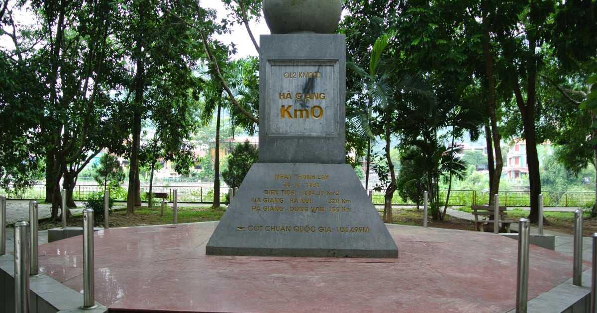
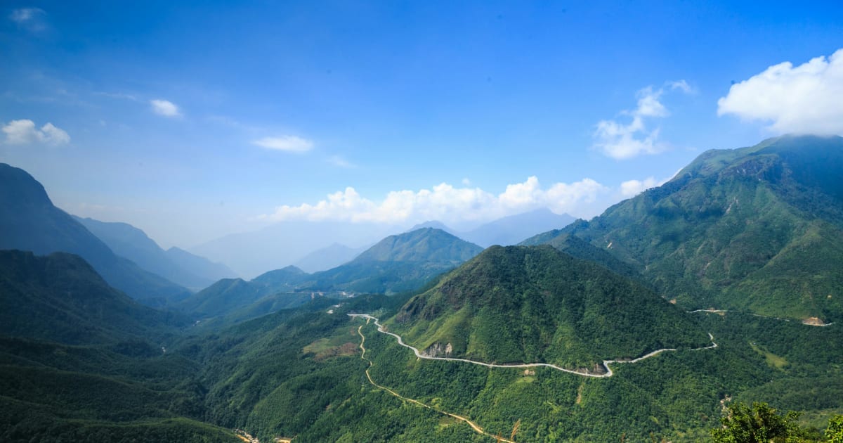
The Ha Giang Loop is Vietnam's most dramatic motorbike route - a 350km circuit through the Dong Van Karst Plateau UNESCO Global Geopark, past sheer limestone passes, H'Mong villages, buckwheat fields, and the deepest river gorge in Southeast Asia. The town of Ha Giang is the starting point; the loop runs clockwise through Quan Ba, Yen Minh, Dong Van, and Meo Vac before returning via the eastern route through Du Gia. Do it by motorbike - that's the point.

JanFebMarAprMayJunJulAugSepOctNovDec
Nature & Outdoors
TrekkingCyclingSwimmingKayakingHiking
Culture & History
CultureHistoryPhotographyHomestay
Đồng Văn Old Town
🎎 Cultural
Đồng Văn Old Town
Đồng Văn Old Town - a preserved French colonial and Qing-era stone quarter perched at 1,600m on Vietnam's northernmost plateau, surrounded by dramatic karst peaks and H'Mông villages.
Du Già Village
🎎 Cultural
Du Già Village
Du Già is the most beautiful village on the eastern Ha Giang Loop - a Tày settlement in a river valley surrounded by limestone karst, rice terraces, and waterfalls, with some of the best homestay accommodation on the entire loop and a genuine community that exists independently of tourism.
Du Già Waterfall
💧 Waterfall
Du Già Waterfall
Du Già Waterfall is a multi-tier cascade deep in the valley forest above Du Già Village - reached by a 3km riverside trek, with natural pools at the base for swimming and the dense karst forest of the eastern Ha Giang Loop surrounding it.
Lô Lô Chải Village
🎎 Cultural
Lô Lô Chải Village
Lô Lô Chải Village - one of Vietnam's most intact ethnic minority villages, home to the Lô Lô people at the foot of Lũng Cú's Dragon Mountain, with traditional stone houses, distinctive indigo textiles, and a culture found nowhere else in the world.
Lũng Cú Flag Tower
Attraction
Lũng Cú Flag Tower
Lũng Cú Flag Tower - Vietnam's northernmost point on Dragon Mountain, where a massive national flag flies above the karst plateau with China visible across the valley below.
Mã Pí Lèng Pass
🏔️ Mountain
Mã Pí Lèng Pass
Mã Pí Lèng Pass - Vietnam's most dramatic mountain road, a 20km switchback carved into sheer limestone cliffs above the turquoise Nho Quế River canyon, 1,500m below.
Nho Quế River
🌿 Nature
Nho Quế River
Nho Quế River - a ribbon of impossible turquoise threading through the deepest canyon in Southeast Asia, seen from above at Mã Pí Lèng Pass and explored by boat from Mèo Vạc.
Quản Bạ Heaven Gate
🌿 Nature
Quản Bạ Heaven Gate
Quản Bạ Heaven Gate is the first dramatic viewpoint on the Ha Giang Loop - a mountain pass at 1,500 metres where the road crests and the entire Quản Bạ Valley opens below, with the Twin Mountains rising from the valley floor and, in the right season, a sea of clouds filling the basin at dawn.
Quản Bạ Twin Mountains
🏔️ Mountain
Quản Bạ Twin Mountains
The Quản Bạ Twin Mountains - Núi Đôi, 'Double Mountains' - are two symmetrical limestone peaks rising from the Quản Bạ Valley floor, an icon of the Ha Giang Loop and the subject of a Tày legend about a fairy who left her twin children behind when she was called back to heaven.
Thẩm Mã Pass
🏔️ Mountain
Thẩm Mã Pass
Thẩm Mã Pass - a lesser-known but stunning mountain pass on the Hà Giang Loop between Yên Minh and Đồng Văn, with sweeping views over terraced valleys and karst peaks that rival the more famous passes.
Yên Minh Pine Forest
🌿 Forest
Yên Minh Pine Forest
The Yên Minh Pine Forest is an unexpected stretch of highland pine on the Ha Giang Loop between Quản Bạ and Đồng Văn - a 10km section of road through dense Pinus kesiya forest at 1,200 metres, with morning mist threading between the trees and a completely different atmosphere from the surrounding karst landscape.
3D2NFast loop - highlights only
Day 1Ha Giang → Quan Ba Heaven Gate → Yen Minh → Dong Van~145km

Leave before 7am. First stop is Quan Ba Heaven Gate at 1,500m - the valley and Twin Mountains below are the first real taste of Ha Giang scenery. Lunch in Yen Minh. Arrive Dong Van for sunset and evening in the old quarter.

Day 2Dong Van → Lung Cu → Ma Pi Leng Pass → Meo Vac~80km

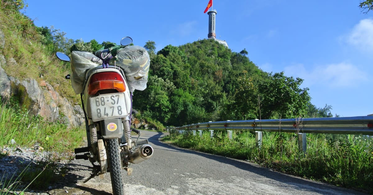
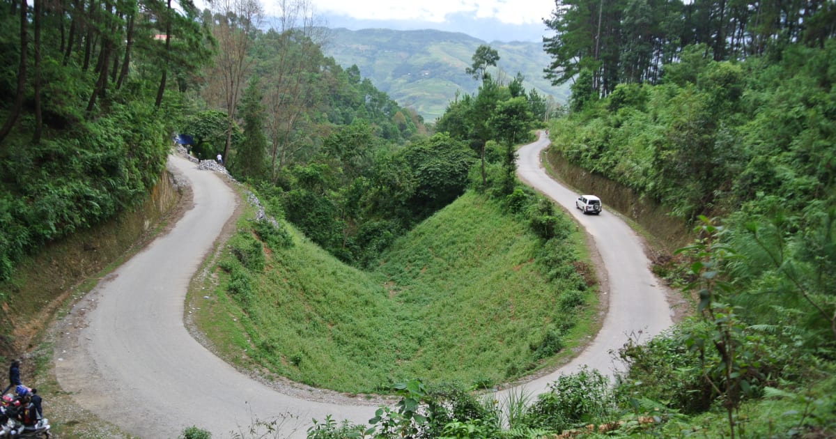
The best day of the loop. Lung Cu Flag Tower at Vietnam's northernmost point - China visible across the valley. Ma Pi Leng Pass is one of the most dramatic roads in Southeast Asia - 20km of switchbacks above the Nho Que River canyon. Optional boat trip on the Nho Que from Meo Vac (~150,000 VND/person). Ma Pi Leng Skywalk at sunset.

Day 3Meo Vac → Du Gia → Ha Giang~150km

Return route along QL34 following the Gam River - less dramatic than the outward route but still beautiful. Du Gia village for lunch. Du Gia Waterfall for a swim if weather allows. Back in Ha Giang by evening.

4D3NStandard loop - recommended
Day 1Ha Giang → Quan Ba → Yen Minh~100km

Relaxed first day. Quan Ba Heaven Gate for the first jaw-dropping view. Yen Minh Pine Forest - an unexpected stretch of highland pine that changes the atmosphere completely. Optional: Lung Khuy Cave near Yen Minh.

Day 2Yen Minh → Lung Cu → Dong Van~80km

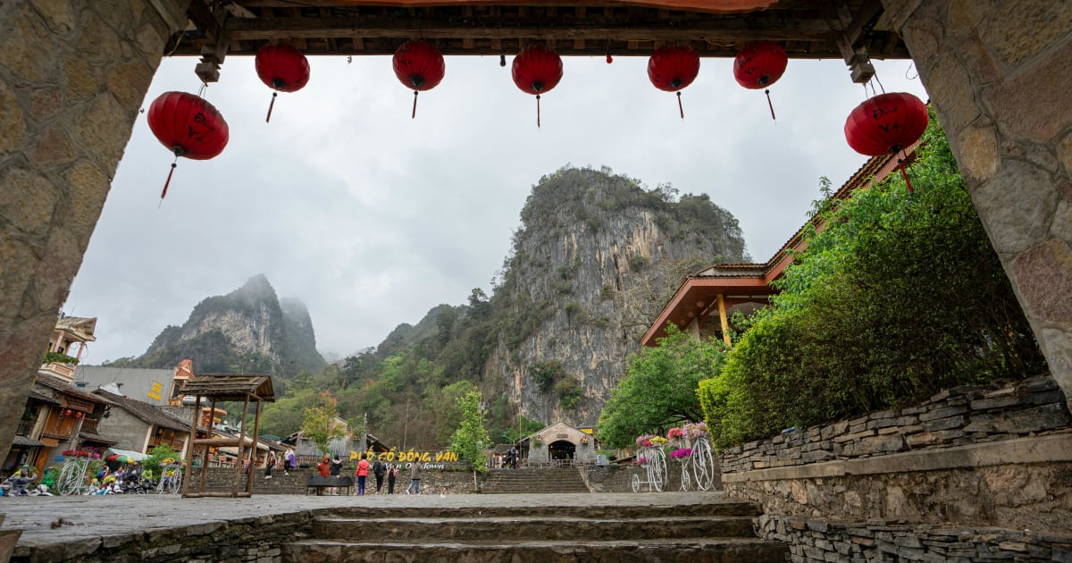
Tham Ma Pass before the plateau opens up. Hmong King Palace (Vuong Family Mansion) at Sa Phin - the most elaborate H'Mong building in Vietnam. Lung Cu Flag Tower at Vietnam's northernmost point. Lo Lo Chai village below the tower - the Lo Lo minority culture is found almost nowhere else. Dong Van Old Quarter for dinner and the night market.

Day 3Dong Van → Ma Pi Leng Pass → Meo Vac~45km

Shortest day in distance, longest in impact. Ma Pi Leng Pass at its own pace - stop at every viewpoint. Optional Nho Que river boat trip from Meo Vac. Happiness Road Museum in Meo Vac. Ma Pi Leng Skywalk at sunset - walk or ride the narrow path to the viewpoint above the canyon.

Day 4Meo Vac → Du Gia → Ha Giang~150km

Early start. QL34 return route along the Gam River. Du Gia is the most beautiful village on the eastern loop - Tay settlement in a river valley. Du Gia Waterfall for a swim. Back in Ha Giang by late afternoon.

🚌
Hanoibus
6–7 hours200,000–350,000 VND

Daily buses and limousine vans from My Dinh bus station to Ha Giang city. Limousine vans are more comfortable for the same price. Most drop off in the city centre near the motorbike rental shops.

🏍️
Hanoimotorbike
8–10 hoursPetrol only

Experienced riders only. 300km via QL2. Good option if you want to ride your own bike the entire way.

Budget
400,000–700,000 VND/day
Mid-range
700,000–1,200,000 VND/day
Comfortable
1,200,000–2,500,000 VND/day

Budget: self-ride rental bike + homestay + local food. Mid-range: Easy Rider (local driver takes you on their bike). Comfortable: Jeep tour with accommodation included. Border area permit required for all foreign visitors: ~250,000 VND.

📅
Best Time to Visit
Sep–Nov: golden rice terraces + buckwheat flowers in Oct–Nov. Mar–Apr: white mustard flowers, clear skies. Avoid Jun–Aug: heavy rain, landslide risk.
🌙
Recommended Stay
3–5 days for the full loop
📱
SIM & Connectivity
Viettel or Vietnamobile available locally. Unlimited data from ~150,000 VND/month.
⚠️
Scam Alerts
Use Grab for transport. Agree on prices upfront for any local services.
💰
Money
Cash-first destination. Withdraw VND at ATMs - avoid airport exchange booths.
🏥
Emergency
Police: 113 · Ambulance: 115 · Fire: 114
Explore the region
🏔️ North Vietnam
View all destinations →