36 places
Cycling in Vietnam
Rice fields, coastal roads, and countryside lanes by bike
36 locations for cycling
Beach
An Bang Beach
quang nam
An Bang Beach is Hội An's most accessible beach - a wide stretch of white sand 3-5km east of the Ancient Town, reachable by bicycle through rice paddies in 20-30 minutes. Calmer and less developed than Đà Nẵng's city beaches, with beach bars, watersports, and good sunrise views.

Lake
Ba Om Lake
tra vinh
Ba Om Lake in Trà Vinh is a sacred Khmer reservoir tied to a famous folk legend about a nighttime pond-digging contest between men and women, surrounded by hundreds of centuries-old sao and dầu trees and anchored by the Âng Pagoda - one of the oldest Khmer temples in Vietnam.

History
Bến Hải River & Hiền Lương Bridge
quang tri
The Bến Hải River and Hiền Lương Bridge mark the former demilitarized zone that divided Vietnam at the 17th parallel from 1954 to 1975 - one of the most historically significant and quietly moving sites on the Vietnam War trail in Quảng Trị, its reconstructed bridge still painted blue on the north half and yellow on the south.

Pagoda
Bích Động Pagoda
ninh binh
Bích Động Pagoda is a 300-year-old cave temple complex built into a limestone karst in Ninh Bình - three separate temples (Lower, Middle, Upper) climb the mountain face via more than 100 stone steps, once ranked 'second most beautiful grotto in Vietnam'. Free entry; best combined with a Tam Cốc boat tour.

Beach
Bình Sơn Beach
ninh thuan
Bình Sơn Beach is Phan Rang's city beach, just 2-3km from downtown and connected directly to Ninh Chữ beach, with a modern seafront park, fine white sand, and reliably clear water in a province that gets less rain than anywhere else in Vietnam.
Beach
Cần Giờ Beach
ho chi minh city
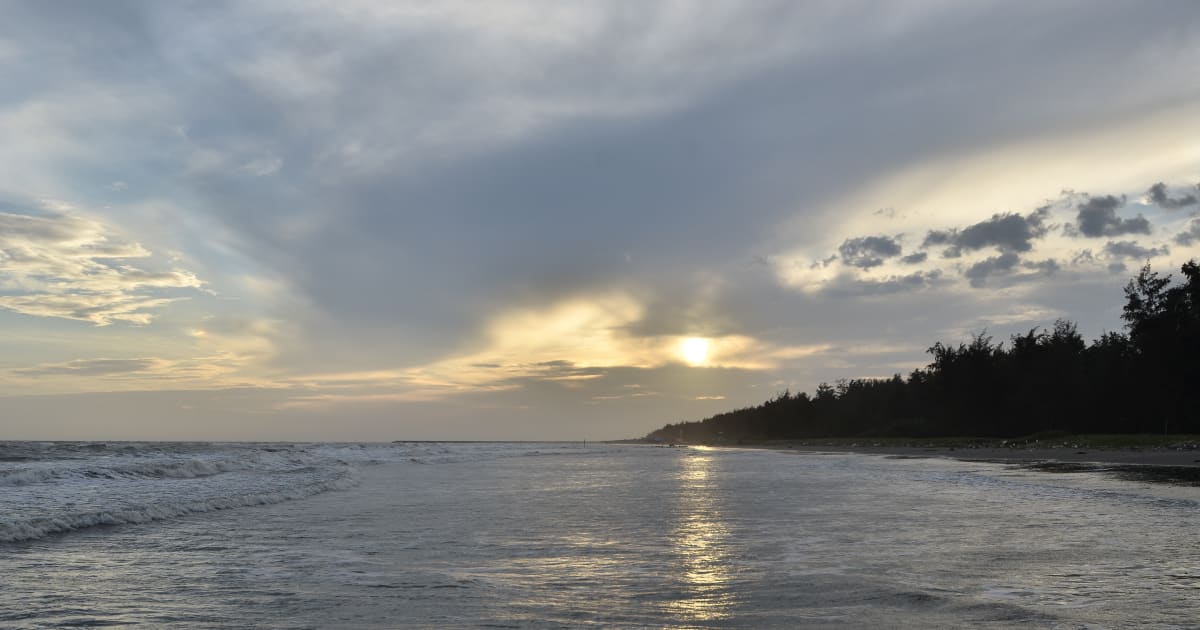
Cần Giờ Beach (also called Bãi biển 30/4), Ho Chi Minh City's own beach district, is a roughly 50km drive from District 1 through mangrove forest to a dark-sand coastal town where Saigonese come for weekend seafood, a swim, and a break from the city without leaving city limits - though a major land reclamation project is set to reshape this coastline in the coming years.
Forest
Cát Tiên National Park
dong nai
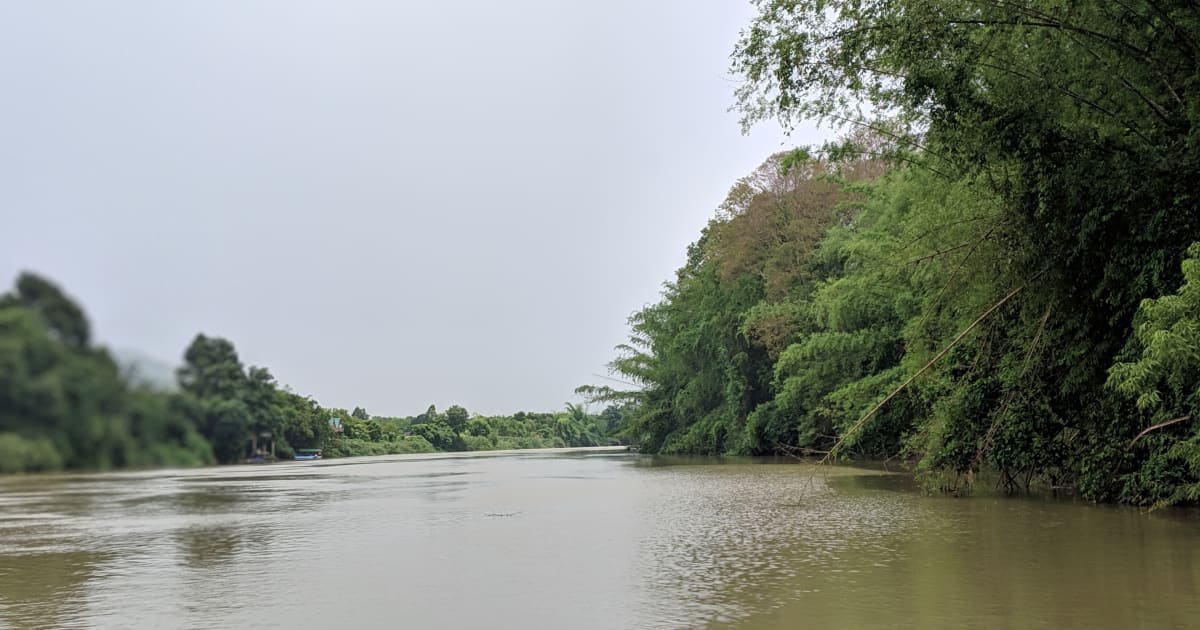
Cát Tiên National Park - established 1992, 71,920 hectares (larger than Singapore), UNESCO Biosphere Reserve. Over 1,610 plant species, 1,568 animal species, 300+ bird species (nearly 50% of Vietnam's total). Once the last mainland Asian refuge of the Javan rhinoceros, declared extinct here in 2010. Winner of 4 awards at the 2025 AEN International Ecotourism Awards including top prize for Biodiversity Conservation.
Beach
Cửa Đại Beach
quang nam
Cửa Đại Beach is the closest beach to Hội An Ancient Town - 4km east on a flat cycling road, with views of the Cham Islands on the horizon, though the beach itself has been narrowed by years of erosion and is currently the site of a major, actively under-construction land reclamation project expected to finish in 2026.

Lake
Dầu Tiếng Lake
tay ninh
Dầu Tiếng Lake is the largest artificial reservoir in Vietnam - a 270km² expanse of water on the Tây Ninh and Bình Dương border, surrounded by forest and used for irrigation, with sunrise photography, lakeside cycling, and the nearby Chùa Thái Sơn temple on Núi Cậu among the main visitor draws.
Beach
Dốc Lết Beach
khanh hoa
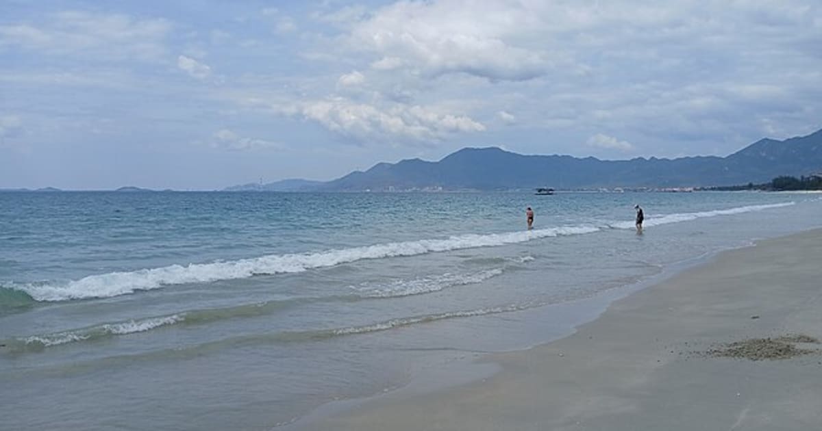
Dốc Lết Beach is Nha Trang's best day-trip beach - a long stretch of white sand on a sheltered bay 50km north of the city, with calmer and clearer water than Nha Trang's main beach, significantly fewer crowds, and a name that comes from the soft, sinking sand dunes visitors once had to shuffle across to reach the sea.

Cultural
Don Village
thanh hoa
Don Village (Bản Đôn) is the most popular Thai village in Pù Luông Nature Reserve - a hillside settlement of traditional stilt houses set above a wide bowl of terraced rice fields, and the main base for homestays, retreats, and trekking in the reserve.
Cultural
Du Già Village
ha giang
Du Già is a Tày and H'mông village 70km from Hà Giang city on the eastern Ha Giang Loop - quieter and harder to reach than the main loop, with rice terraces, red silk-cotton trees lining the road, and homestays that attract travellers who want the experience over the Instagram shot.

History
Hoa Lư Ancient Capital
ninh binh
Hoa Lư was Vietnam's first independent capital - a 10th-century fortress city built inside a natural ring of limestone karsts, where the Đinh, Early Lê, and the start of the Lý dynasties ruled a newly unified Vietnam from 968 to 1010 AD. One of 4 core zones of the Tràng An UNESCO World Heritage Site (recognised 2014). Note: this is the historic Cố Đô Hoa Lư in Trường Yên - not to be confused with the newer 'Phố Cổ Hoa Lư' recreated old-town tourist complex in Ninh Bình city centre.

Island
Hòn Sơn Island
kien giang
Hòn Sơn is a large mountainous island in the Gulf of Thailand, Kiên Giang - calmer seas and a shorter crossing than Phú Quý, with clear water, Ma Thiên Lãnh peak, fishing villages, and almost no resort development. Minimum 2 nights to do it properly.

Mountain
Khau Phạ Pass
yen bai
Khau Phạ Pass is one of Vietnam's four great mountain passes - a 30km road through the clouds between Tú Lệ and Mù Cang Chải, with the most dramatic views of rice terraces in the country, and the only paragliding launch site in the entire Mù Cang Chải region.

Landmark
Long Bien Bridge
ha noi
Long Bien Bridge is Hanoi's iconic colonial-era steel bridge across the Red River, built by the Daydé & Pillé firm and completed in 1902 - still in active use by trains, motorcycles, and pedestrians more than 120 years after construction.
Mountain
Mã Pí Lèng Pass
ha giang
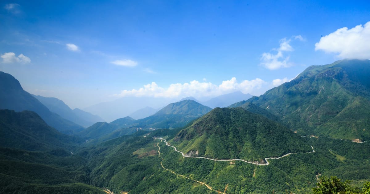
Mã Pí Lèng Pass - Vietnam's most dramatic mountain road, a 20km switchback carved into sheer limestone cliffs above the turquoise Nho Quế River canyon. Built 1959-1965 by over 2,000 workers from 16 ethnic groups who hung from ropes on the cliff faces for nearly a year.

Nature
Moc Chau Tea Hills
son la
The Moc Chau Tea Hills are vast rolling plantations of trimmed green tea bushes covering the highland plateau of Son La province, about 10km from Moc Chau town. Most photogenic at dawn when mist settles between the rows - the smell of tea leaves in the cool morning air is one of the defining sensory experiences of the plateau.

Nature
Mũi Cà Mau National Park
ca mau
Mũi Cà Mau National Park is the southernmost point of Vietnam's mainland - a UNESCO Biosphere Reserve of 42,000 hectares of mangrove forest at the tip of the Cà Mau Peninsula, where the East Sea meets the Gulf of Thailand. The only place in Vietnam to watch both sunrise and sunset from the same spot.
Nature
Mũi Trọ Fishing Village
binh thuan
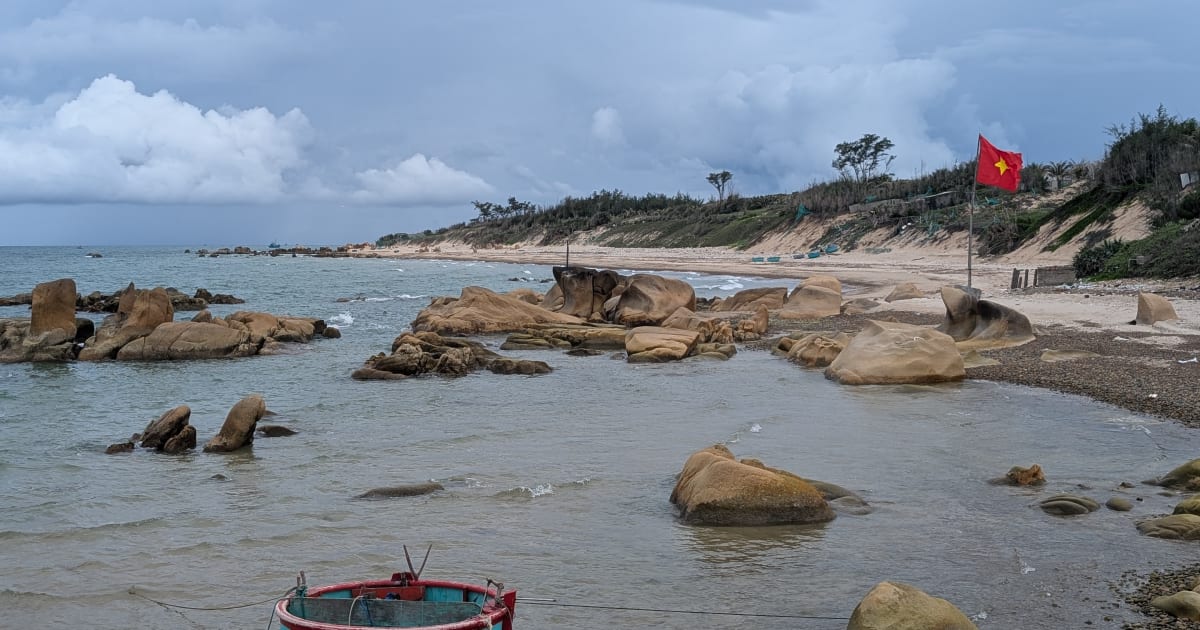
Mũi Trô is a tiny, nameless-on-most-maps fishing village on the Bình Thuận coast - a handful of houses, round basket boats, and a rocky pebble beach that almost no foreign traveler has visited, sitting 2km off the road near Cô Thạch beach.

Island
Nam Du Islands
kien giang
Nam Du is Vietnam's southernmost island archipelago - 21 islands in the Gulf of Thailand, closer and cheaper than Phú Quốc, with clearer water, outer islands for snorkeling, and a genuine fishing community character. 2 hours from Rạch Giá by high-speed ferry.

Mountain
O Quy Ho Pass
lao cai, lai chau
Ô Quy Hồ Pass is one of Vietnam's 'tứ đại đỉnh đèo' (four great passes) - the longest mountain pass in the northwest at 50km, crossing the Hoàng Liên Sơn range at 2,035m between Sapa and Lai Châu. Named after the mournful cry of a bird in a tragic love legend.

Cultural
Phoenix & Unicorn Islands (Cồn Phụng & Cồn Thới Sơn)
ben tre, tien giang
Phoenix Island (Cồn Phụng) and Unicorn Island (Cồn Thới Sơn) are two of the Mekong Delta's famous Tứ Linh islands near My Tho, known for coconut canals, sampan rides, fruit orchards, and the unusual Coconut Religion temple.

Nature
Phong Nặm Valley
cao bang
Phong Nậm Valley is one of Cao Bằng's most beautiful hidden gems - a wide agricultural valley where the Quây Sơn River winds between limestone peaks and golden rice fields, 15km from Trùng Khánh and 25km upstream from Bản Giốc Waterfall. September to October is peak season when the harvest turns the valley floor gold.
Nature
Phong Nha Botanic Garden
quang binh
Phong Nha Botanic Garden is a protected forest reserve on the edge of Phong Nha-Kẻ Bàng National Park, 7km from Sơn Trạch village - despite the name, the main draw is a jungle trek to Gió Waterfall and its natural swimming holes, not a classic flower garden.

Beach
Phước Bình Beach
vung tau
Phước Bình Beach is a 4km stretch of quiet coastline next to Phước Tĩnh fishing village, tucked behind a row of resorts between Long Hải and Hồ Tràm. Almost no tourist presence - barely shows up in Google search results. Best October to November.

Island
Phú Quý Island
binh thuan
Phú Quý Island (also known as Cù Lao Thu) is a remote coral island 120km off the Bình Thuận coast with some of the clearest water and best diving in southern Vietnam - a 2.5 to 3.5 hour ferry from Phan Thiết that delivers a genuine fishing island experience with minimal resort infrastructure.

Nature
Ta Pa Fields
an giang
Ta Pa Fields are a landscape of traditional floating rice paddies in the Seven Mountains region of An Giang province, submerged each flood season when the Mekong Delta rises. The combination of water-covered fields, distant mountain silhouettes, and Khmer stilt village architecture makes it one of the most distinctive seasonal landscapes in southern Vietnam.

Nature
Tam Cốc
ninh binh
Tam Cốc - three river caves carved through limestone karst in Ninh Bình, rowed by local women through flooded rice paddies that turn gold in harvest season. Part of the Tràng An UNESCO dual heritage site. Best mid-May to mid-June for golden rice.

Mountain
Thẩm Mã Pass
ha giang
Thẩm Mã Pass (also called Dốc Chín Khoanh, the 'nine-bend slope') is a dramatic, historically named mountain pass on Highway 4C between Yên Minh and Đồng Văn on the Hà Giang Loop - one of the route's most famous photo stops, which also means it's one of its most crowded, especially during the Sep-Nov buckwheat flower season.
Landmark
Thường Phước Border Gate
dong thap
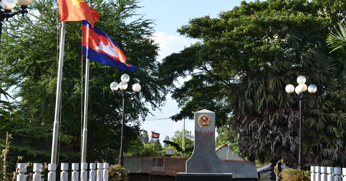
Thường Phước Border Gate in Đồng Tháp is one of the Mekong Delta's international river crossings into Cambodia - a working border post on the Mekong marked by Border Marker 240, where boats, traders, and travelers cross into Cambodia's Prey Veng province via the connecting Kaoh Roka border post.
Town
Trà Quế Village
quang nam
Trà Quế is a 300-year-old herb farming village 3km from Hội An Ancient Town - a dense patchwork of organic herb plots tended by hand using traditional methods, recognised as a National Intangible Cultural Heritage, where visitors can join farmers for a morning, learn to cook Vietnamese dishes, and eat lunch in the fields.

Lake
Tri An Lake
dong nai
Tri An Lake is a large reservoir in Dong Nai province, 65-70km from Ho Chi Minh City, formed by the Tri An hydroelectric dam on the Dong Nai River. A popular weekend camping and kayaking destination for city residents, with 76 forested islands, calm water, and dramatic sunset views.
Nature
Tuyền Lâm Lake
lam dong
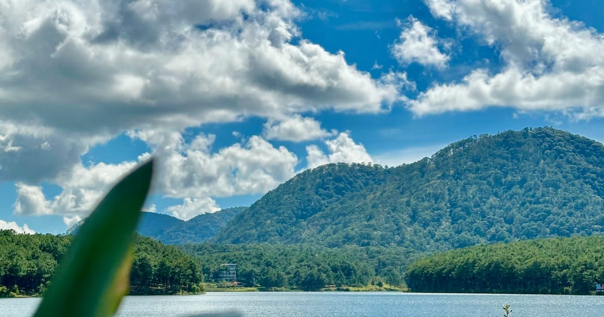
Tuyền Lâm Lake is Đà Lạt's largest reservoir - one of the largest bodies of water in the area, surrounded by pine forests, accessible by cable car, kayak, or bicycle, with Trúc Lâm Thiền Monastery perched on Phụng Hoàng Mountain above the northern shore.

Cultural
Việt Hải Village
hai phong
Việt Hải is a fishing and farming village of 87 households inside Cát Bà National Park - nicknamed 'island within an island', reachable only by boat from Bến Bèo or by a 12km jungle trek through the national park. No road access to the outside world.
Lake
West Lake
ha noi
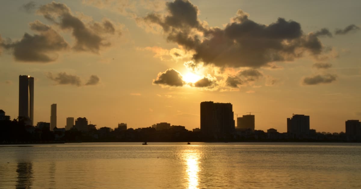
West Lake is Hanoi's largest lake - a 500-hectare expanse in the Tây Hồ district ringed by upscale cafes, ancient pagodas, seafood restaurants, and a 17km cycling path that offers the most pleasant outdoor escape within the city limits.
Browse other experiences
Beaches44 placesTrekking76 placesCamping33 placesCaving12 placesSnorkeling19 placesKayaking22 placesFood24 placesCulture116 placesHistory78 placesPhotography238 placesMarkets5 placesNightlife8 placesWalking Tours98 placesBoat Tours41 placesCable Cars5 placesHomestays9 placesWildlife37 placesMotorcycling31 placesShopping2 places