37 places
Boat Tours in Vietnam
Overnight cruises, river boats, and bamboo rafts
37 locations for boat tours
🏝️ Island
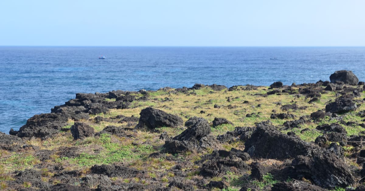
Đảo Bé (An Bình Island)
📍 quang ngai
Đảo Bé - also known as An Bình Island or Cù Lao Bờ Bãi - is a small outer island 3 nautical miles northwest of Lý Sơn's main island, reachable by a 10-15 minute boat ride. With clearer water, more intact coral reefs, and a fraction of the crowds of the main island, it's the best snorkeling location in the Lý Sơn archipelago and a quieter alternative for a half-day by the sea.

📍 Lake
Ba Be Lake
📍 bac kan
Ba Be Lake is Vietnam's largest natural freshwater lake - three connected bodies of water (Pé Lèng, Pé Lù, Pé Lầm) stretching 8km through karst mountains in Bắc Kạn. Ramsar Wetland site, Tày homestays, boat through Puong Cave, and some of the most intact lowland forest in the northern highlands.

🏝️ Island
Ba Hòn Đầm Islands
📍 kien giang
Ba Hòn Đầm is a cluster of three small islands in the Bà Lụa Archipelago, Kiên Lương - known as the 'mini Ha Long of the South', 20km offshore with calm shallow water between the islands, colourful pebble beaches, and bioluminescence at night from November to April.

🏝️ Island
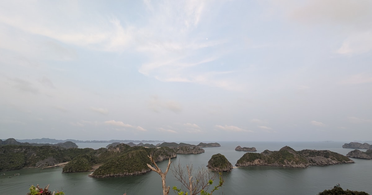
Bai Tu Long Bay
📍 quang ninh
Bái Tử Long Bay - Ha Long's quieter neighbour to the northeast - shares the same UNESCO karst landscape with 600+ islands but far fewer cruise boats. Named for the legend of dragon children landing to protect Vietnam. Ha Long Bay the way it was before mass tourism.

🌿 Nature
Ban Gioc Waterfall
📍 cao bang
Bản Giốc is the largest waterfall on any national border in Southeast Asia - a 300-metre-wide curtain of water crashing across three tiers on the Vietnam-China border in Cao Bằng, surrounded by karst mountains and emerald pools.

📍 Lake
Bàu Sấu (Crocodile Lake)
📍 dong nai
Bàu Sấu is a remote oxbow lake deep inside Cát Tiên National Park - a 3-hour jungle trek from the park headquarters leads to one of southern Vietnam's last viable crocodile habitats and a prime birdwatching site.

🌿 Nature
Bảy Mẫu Coconut Forest
📍 quang nam
Bảy Mẫu Coconut Forest is a water coconut palm wetland in Cẩm Thanh village that has grown from its original 7-acre planting to more than 100 hectares today - navigated by traditional Vietnamese basket boats through narrow waterways under the palm canopy, with fishing demonstrations, local music performances, and a real wartime history as a revolutionary base.
📍 Lake
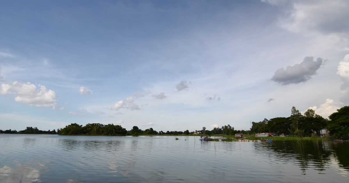
Búng Bình Thiên Lake
📍 an giang
Bưng Bình Thiên is a natural freshwater lake in An Giang's border district, known as the 'holy lake' - it expands dramatically during Mekong flood season and fills with lotus blossoms, surrounded by Cham Muslim villages.

🛒 Market
Cái Răng Floating Market
📍 can tho
Cái Răng Floating Market is the largest wholesale floating market in the Mekong Delta - recognised as national intangible cultural heritage in 2016 and listed by Rough Guides among the world's 10 most impressive markets. Hundreds of wooden boats gather at dawn to trade fruit and produce on the Cần Thơ River, 6km south of the city centre.
🌿 Nature
Cần Giờ Monkey Island
📍 ho chi minh city
Cần Giờ Monkey Island sits inside a UNESCO Biosphere Reserve 50-60km from central Saigon - a river island in the mangrove forest where over 2,000 long-tailed macaques live in large semi-wild troops, reached by boat through the Cần Giờ waterways and often paired with the nearby Rừng Sác War Base on the same day trip.
🌿 Forest
Cát Tiên National Park
📍 dong nai
Cát Tiên National Park - established 1992, 71,920 hectares (larger than Singapore), UNESCO Biosphere Reserve. Over 1,610 plant species, 1,568 animal species, 300+ bird species (nearly 50% of Vietnam's total). Once the last mainland Asian refuge of the Javan rhinoceros, declared extinct here in 2010. Winner of 4 awards at the 2025 AEN International Ecotourism Awards including top prize for Biodiversity Conservation.

📍 Lake
Dầu Tiếng Lake
📍 tay ninh
Dầu Tiếng Lake is the largest artificial reservoir in Vietnam - a 270km² expanse of water on the Tây Ninh and Bình Dương border, surrounded by forest and used for irrigation, with sunrise photography and lakeside cycling as the main visitor draws.
🏝️ Island
Điệp Sơn Island
📍 khanh hoa
Điệp Sơn is a remote island cluster in northern Khánh Hòa where a narrow tidal sandbar connects three islands at low tide - one of Vietnam's most photogenic natural phenomena, reached by boat from Vạn Giã fishing port.
🏝️ Island
Pirate Islands
📍 kien giang
The Hai Tac Islands are a remote archipelago of 16 islands in the Gulf of Thailand off the Kien Giang coast, historically known as the Pirate Islands. One of the least visited island groups in Vietnam, with coral reefs, white sand beaches, and almost no tourist infrastructure.

🏝️ Island
Hon Kho Island
📍 binh dinh
Hòn Khô is a small uninhabited rocky island northeast of Quy Nhơn, known for clear turquoise water, coral reefs, dramatic boulder coastline, and a seasonal golden seaweed (rong mơ) spectacle from May to July when the sea floor turns gold.
🏝️ Island
Hòn Mun Island
📍 khanh hoa
Hòn Mun Island is the core zone of Nha Trang Bay Marine Protected Area, historically the best diving and snorkeling site in the bay - though its coral reefs have suffered serious, well-documented decline since 2020, and current conditions are a genuine mixed bag rather than the pristine reef of older travel guides.

🏝️ Island
Hòn Sơn Island
📍 kien giang
Hòn Sơn is a large mountainous island in the Gulf of Thailand, Kiên Giang - calmer seas and a shorter crossing than Phú Quý, with clear water, Ma Thiên Lãnh peak, fishing villages, and almost no resort development. Minimum 2 nights to do it properly.
🏝️ Island
Hòn Tằm Island
📍 khanh hoa
Hòn Tằm is Nha Trang Bay's most developed private island - a resort island 5km offshore with white sand beaches, clear water, water sports, and coral snorkeling, reached by speedboat in 15 minutes from Cầu Đá pier.

🏝️ Island
Hon Yen Island
📍 phu yen
Hòn Yến is a small coral island 15km north of Tuy Hòa in Phú Yên - two islands (Hòn Yến and Hòn Sụn) connected by a rock path at low tide, with exposed coral reefs, lobster farming, and floating seafood restaurants. Named for the swifts that once nested here.
📍 Landmark
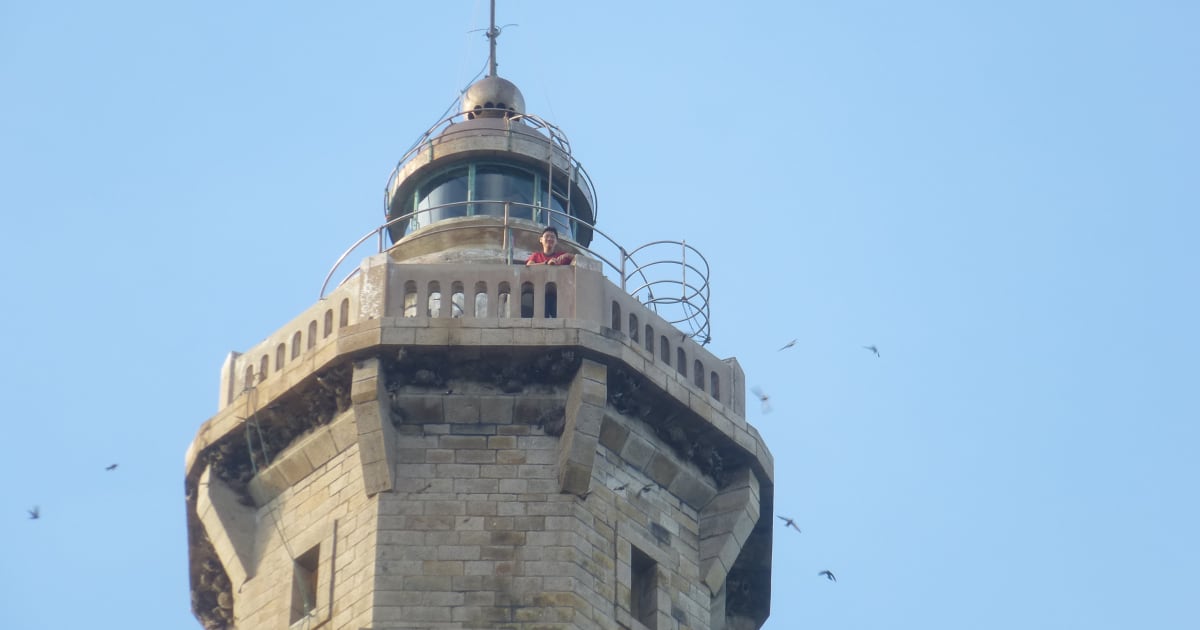
Kê Gà Lighthouse
📍 binh thuan
Kê Gà Lighthouse is a French colonial lighthouse built in 1899 on a granite islet off the Bình Thuận coast - reached by a short boat crossing from the mainland, it is the oldest standing lighthouse in Vietnam and a striking landmark on the south-central coast.

🏖️ Beach
Kỳ Co Beach
📍 binh dinh
Kỳ Co Beach is a secluded 1km² cove near Quy Nhơn with turquoise water, golden sand, and dramatic cliff scenery - 25km from Quy Nhơn city, accessible by speedboat from Nhơn Lý fishing village or by road year-round.
📍 Bay
Lan Hạ Bay
📍 hai phong
Lan Hạ Bay is the southern section of the Ha Long karst system - 400 limestone islands, hidden beaches, floating fishing villages, and some of the clearest water in the Gulf of Tonkin, with a fraction of Ha Long's boat traffic and far better kayaking conditions. The bioluminescence night kayaking tour is an experience Ha Long Bay doesn't offer.

🌿 Nature
Mũi Cà Mau National Park
📍 ca mau
Mũi Cà Mau National Park is the southernmost point of Vietnam's mainland - a UNESCO Biosphere Reserve of 42,000 hectares of mangrove forest at the tip of the Cà Mau Peninsula, where the East Sea meets the Gulf of Thailand. The only place in Vietnam to watch both sunrise and sunset from the same spot.

🏝️ Island
Nam Du Islands
📍 kien giang
Nam Du is Vietnam's southernmost island archipelago - 21 islands in the Gulf of Thailand, closer and cheaper than Phú Quốc, with clearer water, outer islands for snorkeling, and a genuine fishing community character. 2 hours from Rạch Giá by high-speed ferry.

🌿 Nature
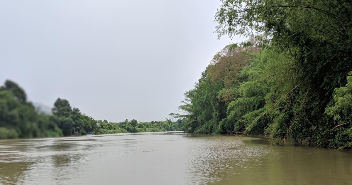
Nho Quế River
📍 ha giang
Nho Quế River - a ribbon of impossible turquoise threading through the deepest canyon in Southeast Asia, seen from above at Mã Pí Lèng Pass and explored by boat from Mèo Vạc.

🎎 Cultural
Phoenix & Unicorn Islands (Cồn Phụng & Cồn Thới Sơn)
📍 ben tre, tien giang
Phoenix Island (Cồn Phụng) and Unicorn Island (Cồn Thới Sơn) are two of the Mekong Delta's famous Tứ Linh islands near My Tho, known for coconut canals, sampan rides, fruit orchards, and the unusual Coconut Religion temple.

🏝️ Island
Phú Quý Island
📍 binh thuan
Phú Quý Island (also known as Cù Lao Thu) is a remote coral island 120km off the Bình Thuận coast with some of the clearest water and best diving in southern Vietnam - a 2.5 to 3.5 hour ferry from Phan Thiết that delivers a genuine fishing island experience with minimal resort infrastructure.
📍 Lake
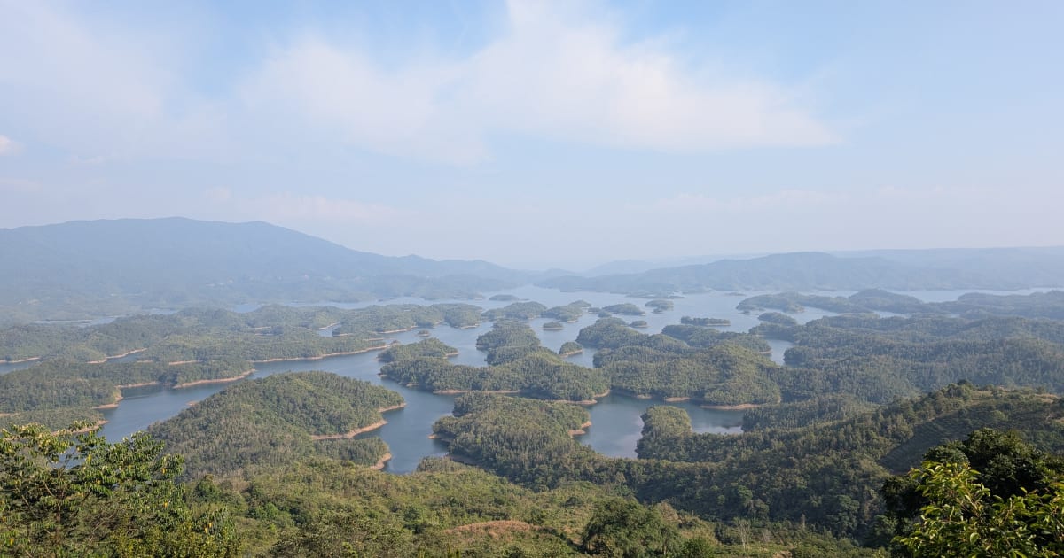
Tà Đùng Lake
📍 dak nong
Tà Đùng Lake in Đắk Nông is called the 'Hạ Long Bay of the Central Highlands' - a reservoir with 47+ forested islands that are actually the hilltops of submerged terrain, formed by the Đồng Nai 3 hydroelectric dam. Sea of clouds visible at 5-6 AM during rainy season. 250km from Saigon.

🌿 Nature
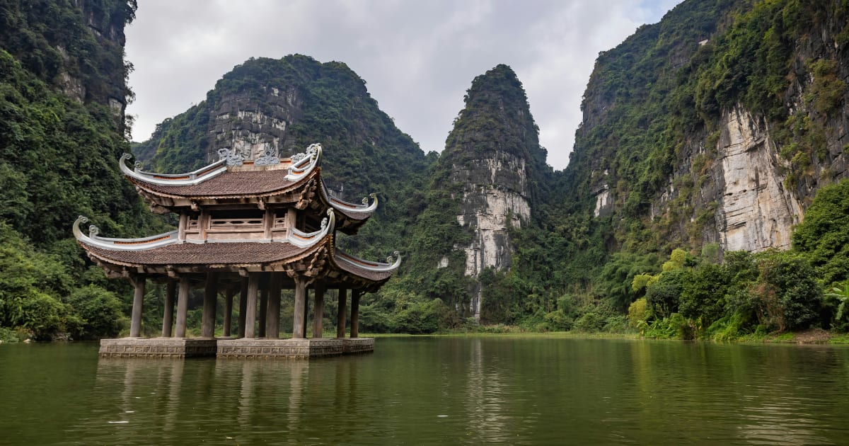
Tam Cốc
📍 ninh binh
Tam Cốc - three river caves carved through limestone karst in Ninh Bình, rowed by local women through flooded rice paddies that turn gold in harvest season. Part of the Tràng An UNESCO dual heritage site. Best mid-May to mid-June for golden rice.
📍 Landmark
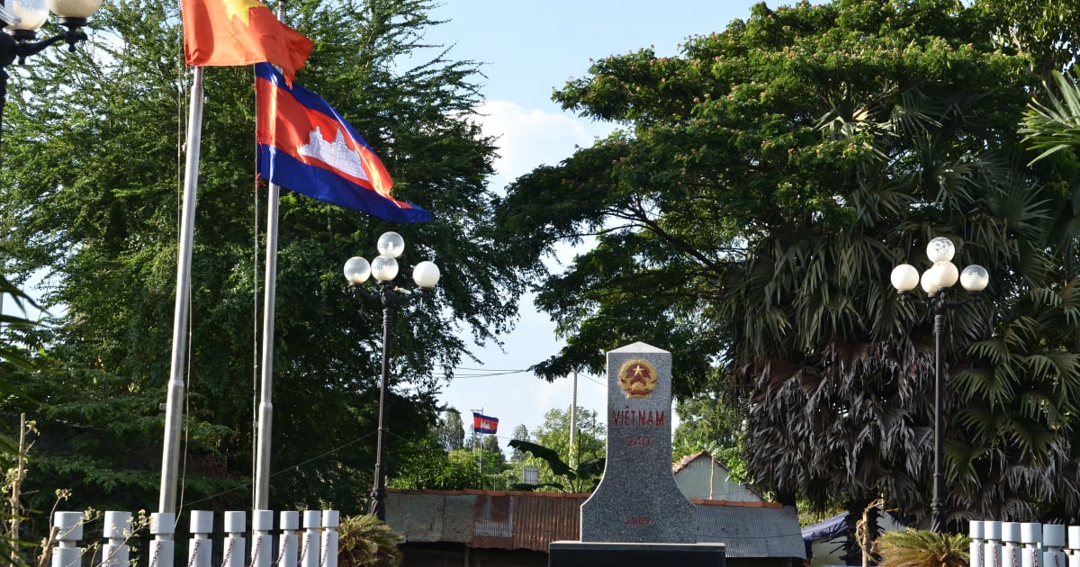
Thường Phước Border Gate
📍 dong thap
Thường Phước Border Gate in Đồng Tháp is one of the Mekong Delta's international river crossings into Cambodia - a working border post on the Mekong where boats, traders, and travelers cross between Vietnam and Kandal Province.

🎎 Cultural
Thiên Mụ Pagoda
📍 hue
Thiên Mụ Pagoda is the oldest and most iconic religious site in Huế - a 21-metre seven-tiered tower, officially recognised as Vietnam's tallest ancient octagonal pagoda tower, on a hill above the Perfume River, founded in 1601 and part of the UNESCO-listed Complex of Huế Monuments.

🌿 Nature
Thung Nham Bird Park
📍 ninh binh
Thung Nham Bird Park is a flooded karst valley and wetland in Ninh Bình home to one of northern Vietnam's largest egret and heron colonies - over 40,000 birds nesting in the bamboo forest during breeding season, explored by rowing boat through the flooded valley.

🌿 Forest
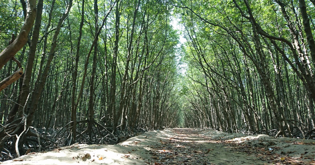
Trà Sư Cajuput Forest
📍 an giang
Trà Sư Cajuput Forest is an 845-hectare flooded cajuput woodland in An Giang - navigated by rowboat through mirror-flat green waterways, with over 70 bird species, a 10km bamboo walkway through the forest, and an observation tower over the canopy. Best September to November.
🌿 Nature
Trang An
📍 ninh binh
Trang An is Vietnam's only UNESCO dual World Heritage Site (natural and cultural, 2014) - a labyrinth of karst peaks, jade rivers, and ancient caves navigated by wooden rowboat. Known as 'Ha Long Bay on land' and a filming location for Kong: Skull Island (2017).

📍 Lake
Tri An Lake
📍 dong nai
Tri An Lake is a large reservoir in Dong Nai province, 60km from Ho Chi Minh City, formed by the Tri An hydroelectric dam on the Dong Nai River. A popular weekend camping and kayaking destination for city residents, with forested islands, calm water, and dramatic sunset views.
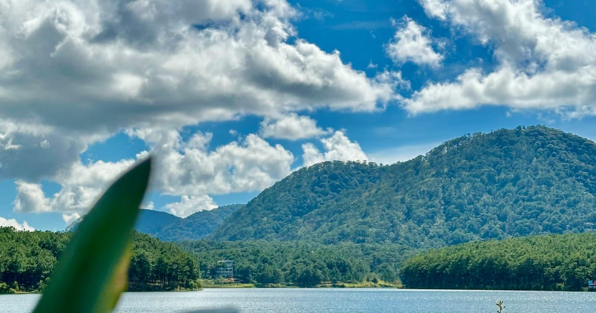
🌿 Nature
Tuyền Lâm Lake
📍 lam dong
Tuyền Lâm Lake is Đà Lạt's largest reservoir - a 320-hectare expanse of calm water surrounded by pine forests, accessible by cable car, kayak, or bicycle, with Trúc Lâm Thiền Monastery on the hillside above the northern shore.

🌿 Nature
Vân Long Nature Reserve
📍 ninh binh
Vân Long Nature Reserve is Vietnam's largest inland wetland - a flooded valley of karst peaks, submerged rice fields, and clear shallow water navigated by rowing boat, home to Vietnam's largest population of the critically endangered Delacour's langur.
Browse other experiences
Beaches37 placesTrekking78 placesCamping33 placesCaving12 placesSnorkeling19 placesKayaking23 placesFood24 placesCulture117 placesHistory78 placesPhotography239 placesMarkets5 placesNightlife9 placesWalking Tours81 placesCycling36 placesCable Cars3 placesHomestays9 placesWildlife38 placesMotorcycling31 placesShopping2 places